alb15388976
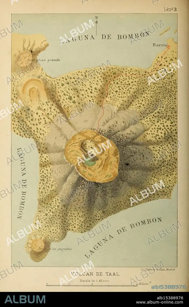
Bosquejo geográfico e histórico-natural del archipiélago Filipino por Don Ramón Jordana y Morera Madrid, Impr. de Moreno y Rojas, 1885 Philippines, natural history, description and travel, A beautifully illustrated map depicting the region of Laguna de Bombon, centered around the Taal Volcano. The map highlights key geographical features, with two distinct lagoons labeled as 'Laguna de Bombon' and 'Laguna grande,' as well as 'Barrio' indicating nearby settlements. The topography of the volcano is intricately detailed, showcasing the crater and surrounding terrain with a blend of colors that enhance the landscape's features. The legend at the bottom indicates the scale of 1:45,000, providing context for the viewer's understanding of the area's proportions.
| Share |
|---|
 Pinterest Pinterest |
 Twitter Twitter |
 Facebook Facebook |
 Copy link Copy link |
 Email Email |
|
Add to another lightbox |
|
Add to another lightbox |


Buy this image.
Select the use:

Caption:
Bosquejo geográfico e histórico-natural del archipiélago Filipino por Don Ramón Jordana y Morera Madrid, Impr. de Moreno y Rojas, 1885 Philippines, natural history, description and travel, A beautifully illustrated map depicting the region of Laguna de Bombon, centered around the Taal Volcano. The map highlights key geographical features, with two distinct lagoons labeled as 'Laguna de Bombon' and 'Laguna grande,' as well as 'Barrio' indicating nearby settlements. The topography of the volcano is intricately detailed, showcasing the crater and surrounding terrain with a blend of colors that enhance the landscape's features. The legend at the bottom indicates the scale of 1:45,000, providing context for the viewer's understanding of the area's proportions.
Credit:
Album / quintlox
Releases:
Model: No - Property: No
Rights questions?
Rights questions?
Image size:
2896 x 4463 px | 37.0 MB
Print size:
24.5 x 37.8 cm | 9.7 x 14.9 in (300 dpi)
Keywords:
000 • 1 • 1885 PHILIPPINES • 45 • AREA'S PROPORTIONS. • BARRIO • BEAUTIFULLY • BLEND • BOSQUEJO GEOGRÁFICO • BOTTOM INDICATES • CENTERED • COLORS • CRATER (GEOLOGY) • CRATER • CRATER, VOLCANO • DE MORENO Y ROJAS • DESCRIPTION • DON RAMÓN JORDANA Y MORERA MADRID • E • ENHANCE • HISTÓRICO-NATURAL DEL ARCHIPIÉLAGO FILIPINO • ILLUSTRATED • IMPR • INDICATING NEARBY SETTLEMENTS • INTRICATELY DETAILED • JOURNEY • JOURNEYMAN'S TRAVEL • JOURNEYMAN'S TRAVELS • LAGUNA DE BOMBON • LAGUNA GRANDE • LANDSCAPE'S FEATURES • LEGEND • LEISURE • MAP DEPICTING • MAP HIGHLIGHTS KEY GEOGRAPHICAL FEATURES • NATURAL HISTORY • NATURAL SCIENCES • NATURE STUDY • POR • PROVIDING CONTEXT • REGION • SCALE • SHOWCASING • SURROUNDING TERRAIN • TAAL VOLCANO • THRIP • TOPOGRAPHY • TRAVEL • TRAVELING • TRAVELS • TRIP • TRIPS • TWO DISTINCT LAGOONS LABELED • VIEWER'S UNDERSTANDING • VOLCANO • VOYAGE • VULCAN • VULCANO • WELL
