alb2193188
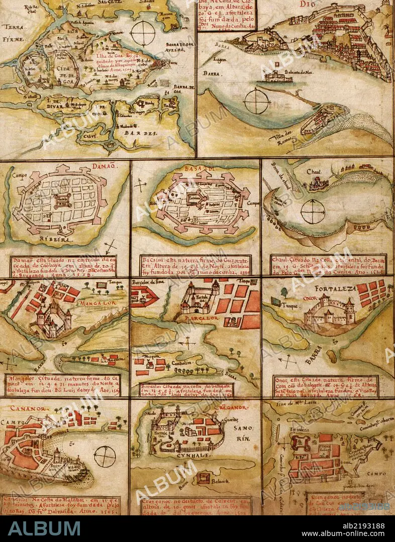
Portuguese map of Fortified Cities on the Coast of Africa & India-1630 1630
| Share |
|---|
 Pinterest Pinterest |
 Twitter Twitter |
 Facebook Facebook |
 Copy link Copy link |
 Email Email |
|
Add to another lightbox |
|
Add to another lightbox |


Buy this image.
Select the use:

Title:
Portuguese map of Fortified Cities on the Coast of Africa & India-1630 1630
Caption:
Fortified Cities on the Coast of Africa & India - 1630
Credit:
Album / Universal Images Group / Universal History Archive/UIG
Releases:
Model: No - Property: No
Rights questions?
Rights questions?
Image size:
3824 x 4983 px | 54.5 MB
Print size:
32.4 x 42.2 cm | 12.7 x 16.6 in (300 dpi)
Keywords:
1630 • ATLAS • CARIBBEAN • CARTOGRAPHIC • CARTOGRAPHY • HARBORS • HARBOURS • INDIES • MAP MAKING • MAP • MAPS • NAVIGATION • NAVIGATIONAL • PLAN (CARTOGRAPHY) • PORTS • PORTUGESE • PORTUGUESE
