alb4070180
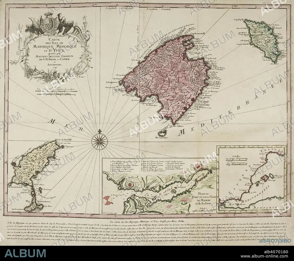
M BELLIN. Decorative map representing the Balearic islands, Minorca, Majorca, and Ibiza. With 2 insets and an ornamental title cartouche. . Carte des Isles de Maiorque, Minorque et d'Yvice. Dressée par M. Bellin. 1741. Source: Maps*19690.(1). Language: French.
| Compartir |
|---|
 Pinterest Pinterest |
 Twitter Twitter |
 Facebook Facebook |
 Copiar enlace Copiar enlace |
 Email Email |
|
Añadir a otro lightbox |
|
Añadir a otro lightbox |


¿Ya tienes cuenta? Iniciar sesión
¿No tienes cuenta? Regístrate
Compra esta imagen.
Selecciona el uso:

Autor:
Descripción:
Ver traducción automática
Decorative map representing the Balearic islands, Minorca, Majorca, and Ibiza. With 2 insets and an ornamental title cartouche. . Carte des Isles de Maiorque, Minorque et d'Yvice. Dressée par M. Bellin. 1741. Source: Maps*19690.(1). Language: French.
Crédito:
Album / British Library
Autorizaciones:
Modelo: No - Propiedad: No
¿Preguntas relacionadas con los derechos?
¿Preguntas relacionadas con los derechos?
Tamaño imagen:
5800 x 4840 px | 80.3 MB
Tamaño impresión:
49.1 x 41.0 cm | 19.3 x 16.1 in (300 dpi)
Palabras clave:
BELLIN, M • CARTOGRAFIA • CARTOGRAFICO • COLOR • COLORES • COLORIDO • IBIZA • MALLORCA • MAPA • MAR MEDITERRANEO • MEDITERRANEO • S. XVIII • SIGLO XVIII
