alb4058806
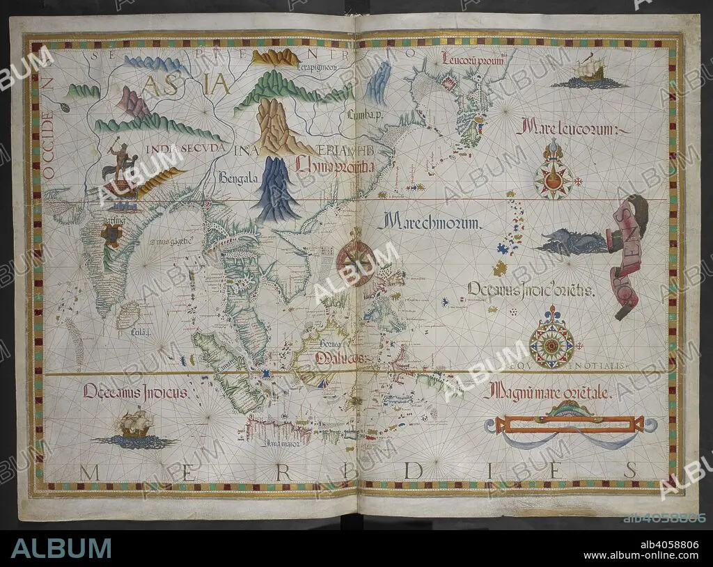
DIEGO HOMEM. Map of Southern Asia and the Spice Islands. Queen Mary Atlas. 1558. Source: Add. 5415 A, ff.17v-18.
| Partager |
|---|
 Pinterest Pinterest |
 Twitter Twitter |
 Facebook Facebook |
 Copier le lien Copier le lien |
 Email Email |
|
Ajouter à une autre Lightbox |
|
Ajouter à une autre Lightbox |


Avez-vous déjà un compte? S'identifier
Vous n'avez pas de compte ? S'inscrire
Acheter cette image.
Sélectionnez l'usage:

Auteur:
Légende:
Voir la traduction automatique
Map of Southern Asia and the Spice Islands. Queen Mary Atlas. 1558. Source: Add. 5415 A, ff.17v-18.
Crédit:
Album / British Library
Autorisations:
Modèle: Non - Propriété: Non
Questions sur les droits?
Questions sur les droits?
Taille de l'image:
6598 x 4909 px | 92.7 MB
Taille d'impression:
55.9 x 41.6 cm | 22.0 x 16.4 in (300 dpi)
Mots clés:
16E SIECLE • 16EME S • ART POPULAIRE INDONESIEN • ASIE • ASIE, CONTINENT • CARTE (GEOGRAPHIE) • CARTE GEOGRAPHIQUE • CARTE • CARTOGRAPHIE • CONTINENT ASIE • COULEUR • COULEURS • DESSIN PLANS • DOCUMENT • HOMEM, DIEGO • INDONESIE • PLAN (CARTOGRAPHIE) • PLANS • SCIENCE: CARTOGRAPHIE • SEIZIÈME SIÈCLE • XVIE SIECLE
