alb4070180
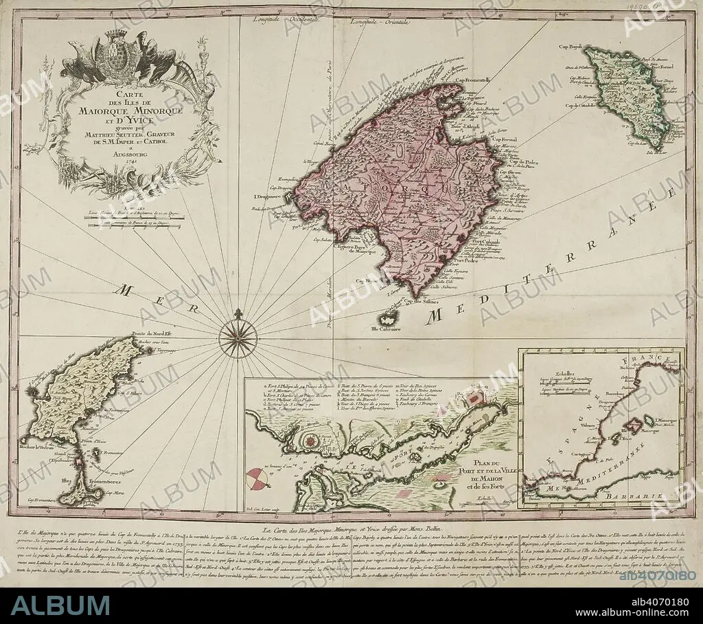
M BELLIN. Decorative map representing the Balearic islands, Minorca, Majorca, and Ibiza. With 2 insets and an ornamental title cartouche. . Carte des Isles de Maiorque, Minorque et d'Yvice. Dressée par M. Bellin. 1741. Source: Maps*19690.(1). Language: French.
| Partager |
|---|
 Pinterest Pinterest |
 Twitter Twitter |
 Facebook Facebook |
 Copier le lien Copier le lien |
 Email Email |
|
Ajouter à une autre Lightbox |
|
Ajouter à une autre Lightbox |


Avez-vous déjà un compte? S'identifier
Vous n'avez pas de compte ? S'inscrire
Acheter cette image.
Sélectionnez l'usage:

Auteur:
Légende:
Voir la traduction automatique
Decorative map representing the Balearic islands, Minorca, Majorca, and Ibiza. With 2 insets and an ornamental title cartouche. . Carte des Isles de Maiorque, Minorque et d'Yvice. Dressée par M. Bellin. 1741. Source: Maps*19690.(1). Language: French.
Crédit:
Album / British Library
Autorisations:
Modèle: Non - Propriété: Non
Questions sur les droits?
Questions sur les droits?
Taille de l'image:
5800 x 4840 px | 80.3 MB
Taille d'impression:
49.1 x 41.0 cm | 19.3 x 16.1 in (300 dpi)
Mots clés:
