alb4088010
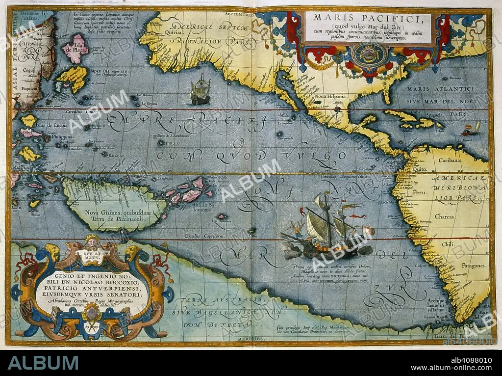
ABRAHAM ORTELIUS. Maris Pacifici. Theatrum Orbis Terrarum. Antwerp, 1595. Map showing the Pacific Ocean and parts of North and South America. Image taken from Theatrum Orbis Terrarum. Originally published/produced in Antwerp, 1595. . Source: Maps.C.2.d.6, 6.
| Teilen |
|---|
 Pinterest Pinterest |
 Twitter Twitter |
 Facebook Facebook |
 Link kopieren Link kopieren |
 Email Email |
|
Zu einem anderen Lightbox hinzufügen |
|
Zu einem anderen Lightbox hinzufügen |


Haben Sie bereits ein Konto? Anmelden
Sie haben kein Konto? Registrieren
Dieses Bild kaufen.
Nutzung auswählen:

Autor: ABRAHAM ORTELIUS (1527-1598)
Untertitel: Siehe automatische Übersetzung
Maris Pacifici. Theatrum Orbis Terrarum. Antwerp, 1595. Map showing the Pacific Ocean and parts of North and South America. Image taken from Theatrum Orbis Terrarum. Originally published/produced in Antwerp, 1595. . Source: Maps.C.2.d.6, 6.
Maris Pacifici. Theatrum Orbis Terrarum. Antwerp, 1595. Map showing the Pacific Ocean and parts of North and South America. Image taken from Theatrum Orbis Terrarum. Originally published/produced in Antwerp, 1595. . Source: Maps.C.2.d.6, 6.
Bildnachweis: Album / British Library
Bildgröße: 7112 × 4950 px | 100.7 MB
Druckgröße: 60.2 × 41.9 cm | 2800.0 × 1948.8 in (300 dpi)
Schlüsselwörter: AMERIKA • AMERIKA, KONTINENT • CUBA • KARTE (KARTHOGRAFIE) • KARTEN • KARTHOGRAFIE • KARTHOGRAPHIE • KARTOGRAFIE (KARTE) • KARTOGRAPHIE • KONTINENT: AMERIKA • KUBA • LANDKARTE • LATEINAMERIKANISCH • MEER • MEERE • ORTELIUS, ABRAHAM • OZEAN • PAZIFIK • PAZIFISCHR OZEAN • PLAN (KARTOGRAPHIE) • SEA • SEESTUECK (GEMAELDE) • SÜDAMERIKA • TOPOGRAPHIE • WISSENSCH.: KARTOGRAPHIE
