alb5405416
Joan Blaeu, El Escorial, 17th Century
| Teilen |
|---|
 Pinterest Pinterest |
 Twitter Twitter |
 Facebook Facebook |
 Link kopieren Link kopieren |
 Email Email |
|
Zu einem anderen Lightbox hinzufügen |
|
Zu einem anderen Lightbox hinzufügen |


Haben Sie bereits ein Konto? Anmelden
Sie haben kein Konto? Registrieren
Dieses Bild kaufen.
Nutzung auswählen:

Titel: Joan Blaeu, El Escorial, 17th Century
Untertitel: Siehe automatische Übersetzung
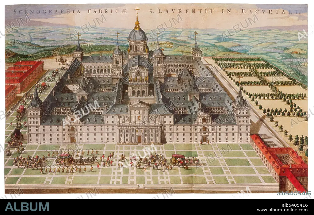
El Escorial is a historical residence of the King of Spain, in the town of San Lorenzo de El Escorial, about 28 miles northwest of the capital, Madrid, in Spain. It is one of the Spanish royal sites and has functioned as a monastery, basilica, royal palace, pantheon, library, museum, university, school and hospital. Joan Blaeu (1596-1673) was a Dutch cartographer, the son of cartographer Willem Blaeu. In 1635 they published the Atlas Novus (full title: Theatrum orbis terrarum, sive, Atlas novus) in two volumes. The Atlas Maior is the final version of Joan Blaeu's atlas, published in Amsterdam between 1662 and 1672, in Latin, French, Dutch, German and Spanish, containing 594 maps and around 3,000 pages of text. The Blaeu maps emphasized fine art and colours, being the most expensive of the time. The Atlas Maior is widely considered a masterpiece of the Golden Age of Dutch/Netherlandish cartography.
El Escorial is a historical residence of the King of Spain, in the town of San Lorenzo de El Escorial, about 28 miles northwest of the capital, Madrid, in Spain. It is one of the Spanish royal sites and has functioned as a monastery, basilica, royal palace, pantheon, library, museum, university, school and hospital. Joan Blaeu (1596-1673) was a Dutch cartographer, the son of cartographer Willem Blaeu. In 1635 they published the Atlas Novus (full title: Theatrum orbis terrarum, sive, Atlas novus) in two volumes. The Atlas Maior is the final version of Joan Blaeu's atlas, published in Amsterdam between 1662 and 1672, in Latin, French, Dutch, German and Spanish, containing 594 maps and around 3,000 pages of text. The Blaeu maps emphasized fine art and colours, being the most expensive of the time. The Atlas Maior is widely considered a masterpiece of the Golden Age of Dutch/Netherlandish cartography.
Bildnachweis: Album / Science Source
Freigaben (Releases): ? Modellfreigabe: Nein - ? Eigentumsfreigabe: Nein
Rechtefragen?
Rechtefragen?
Bildgröße: 4650 × 2944 px | 39.2 MB
Druckgröße: 39.4 × 24.9 cm | 1830.7 × 1159.1 in (300 dpi)
Schlüsselwörter: 17. JAHRHUNDERT • 17. JH. • BERÜHMT • BERÜHMTE PERSÖNLICHKEIT • GEOGRAFIE • GEOGRAPHIE • KARTHOGRAFIE • KARTOGRAFIE (KARTE) • KARTOGRAPHIE • NOTABEL • PROMINENZ • SPANIEN • WISSENSCH.: KARTOGRAPHIE
