alb1962129
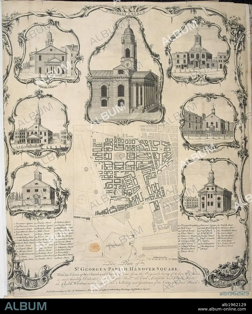
Illustrations of St George's Church, Hanover square, and map of the parish. London churches. . Plan of St. George’s Parish, Hanover Square, with Views of the Church and Chapels of Ease, from the Survey by Morris. London, England. Plan of St. George’s Parish, Hanover Square, with Views of the Church and Chapels of Ease, from the Survey by Morris. G. Bickham, 1761. Source: Maps K.Top.21.2. Language: English.
| Teilen |
|---|
 Pinterest Pinterest |
 Twitter Twitter |
 Facebook Facebook |
 Link kopieren Link kopieren |
 Email Email |
|
Zu einem anderen Lightbox hinzufügen |
|
Zu einem anderen Lightbox hinzufügen |


Haben Sie bereits ein Konto? Anmelden
Sie haben kein Konto? Registrieren
Dieses Bild kaufen

Untertitel:
Siehe automatische Übersetzung
Illustrations of St George's Church, Hanover square, and map of the parish. London churches. . Plan of St. George’s Parish, Hanover Square, with Views of the Church and Chapels of Ease, from the Survey by Morris. London, England. Plan of St. George’s Parish, Hanover Square, with Views of the Church and Chapels of Ease, from the Survey by Morris. G. Bickham, 1761. Source: Maps K.Top.21.2. Language: English.
Bildnachweis:
Album / British Library
Freigaben (Releases):
Model: Nein - Eigentum: Nein
Rechtefragen?
Rechtefragen?
Bildgröße:
3712 x 4388 px | 46.6 MB
Druckgröße:
31.4 x 37.2 cm | 12.4 x 14.6 in (300 dpi)
Schlüsselwörter:
18. JAHRHUNDERT • 18. JH. • ECCLESIA • ENGLAND • EUROPA • GRAVUR • GROSSBRITANNIEN • GROßBRITANNIEN • INNENRAEUME: KIRCHEN • KARTE (KARTHOGRAFIE) • KARTEN • KARTHOGRAFIE • KARTHOGRAPHIE • KARTOGRAFIE (KARTE) • KARTOGRAPHIE • KIRCHE • KIRCHEN • LANDKARTE • LONDON • PLAN (KARTOGRAPHIE) • STICH (KUNST) • WISSENSCH.: KARTOGRAPHIE
