alb4512613
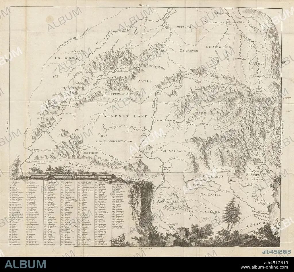
Map of Eastern Switzerland, Map of Grisons, Uri, Glarus, Appenzell, Zurich with inscription of the mountains, etching, plate 15, after S. IX (part 2), 1760, Gottlieb Sigmund Gruner: Die Eisgebirge des Schweizerlandes. Bern: Abraham Wagner, Sohn. 1760.
| Teilen |
|---|
 Pinterest Pinterest |
 Twitter Twitter |
 Facebook Facebook |
 Link kopieren Link kopieren |
 Email Email |
|
Zu einem anderen Lightbox hinzufügen |
|
Zu einem anderen Lightbox hinzufügen |


Haben Sie bereits ein Konto? Anmelden
Sie haben kein Konto? Registrieren
Dieses Bild kaufen.
Nutzung auswählen:

Untertitel:
Siehe automatische Übersetzung
Map of Eastern Switzerland, Map of Grisons, Uri, Glarus, Appenzell, Zurich with inscription of the mountains, etching, plate 15, after S. IX (part 2), 1760, Gottlieb Sigmund Gruner: Die Eisgebirge des Schweizerlandes. Bern: Abraham Wagner, Sohn. 1760.
Bildnachweis:
Album / quintlox
Freigaben (Releases):
Bildgröße:
5778 x 5045 px | 83.4 MB
Druckgröße:
48.9 x 42.7 cm | 19.3 x 16.8 in (300 dpi)
Schlüsselwörter:
