alb8369703
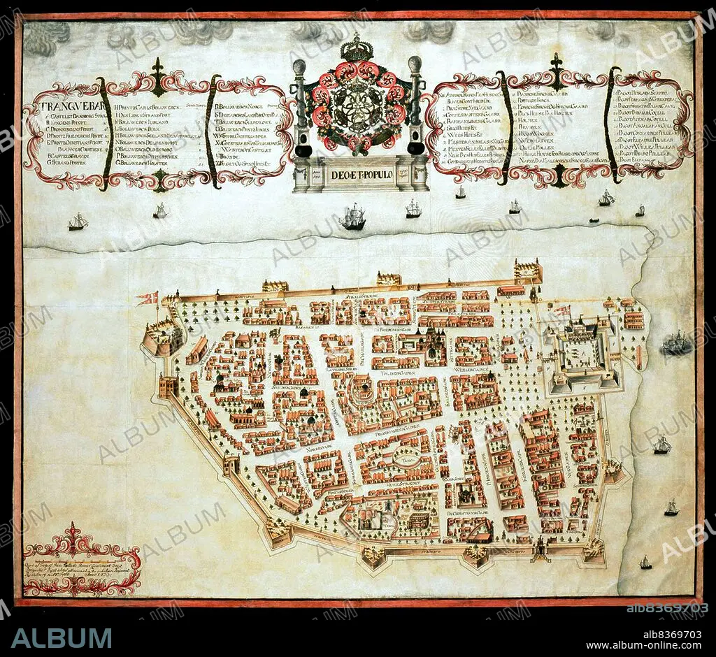
India / Denmark: Map of Tranquebar (Tharangambadi) showing Fort Dansborg, Giorf af Gregers,1733, The Royal Library, Copenhagen
| Teilen |
|---|
 Pinterest Pinterest |
 Twitter Twitter |
 Facebook Facebook |
 Link kopieren Link kopieren |
 Email Email |
|
Zu einem anderen Lightbox hinzufügen |
|
Zu einem anderen Lightbox hinzufügen |


Haben Sie bereits ein Konto? Anmelden
Sie haben kein Konto? Registrieren
Dieses Bild kaufen.
Nutzung auswählen:

Titel: India / Denmark: Map of Tranquebar (Tharangambadi) showing Fort Dansborg, Giorf af Gregers,1733, The Royal Library, Copenhagen
Untertitel: Siehe automatische Übersetzung
Tharangambadi, formerly Tranquebar, is a town in the Nagapattinam district of the Indian state of Tamil Nadu. It lies 15 kilometres (9.3 mi) north of Karaikal, near the mouth of a distributary of the Kaveri River.
. It was a Danish colony from 1620 to 1845, and in Danish it is still known as Trankebar.
Bildnachweis: Album / Universal Images Group / Pictures From History
Freigaben (Releases): ? Modellfreigabe: Nein - ? Eigentumsfreigabe: Nein
Rechtefragen?
Rechtefragen?
Bildgröße: 4700 × 4073 px | 54.8 MB
Druckgröße: 39.8 × 34.5 cm | 1850.4 × 1603.5 in (300 dpi)
Schlüsselwörter: 18. JAHRHUNDERT • 18. JH. • DAENISCH • DÄNEMARK • GEWERBE • IMPERIALISMUS • INDIANER • INDISCH • KARTE (KARTHOGRAFIE) • KARTE • KARTEN • KARTHOGRAFIE • KARTHOGRAPHIE • KARTOGRAFIE (KARTE) • KARTOGRAPHIE • KOLONIALISMUS • LANDKARTE • PLAN (KARTOGRAPHIE) • TAMIL NADU • WISSENSCH.: KARTOGRAPHIE
