alb4450932
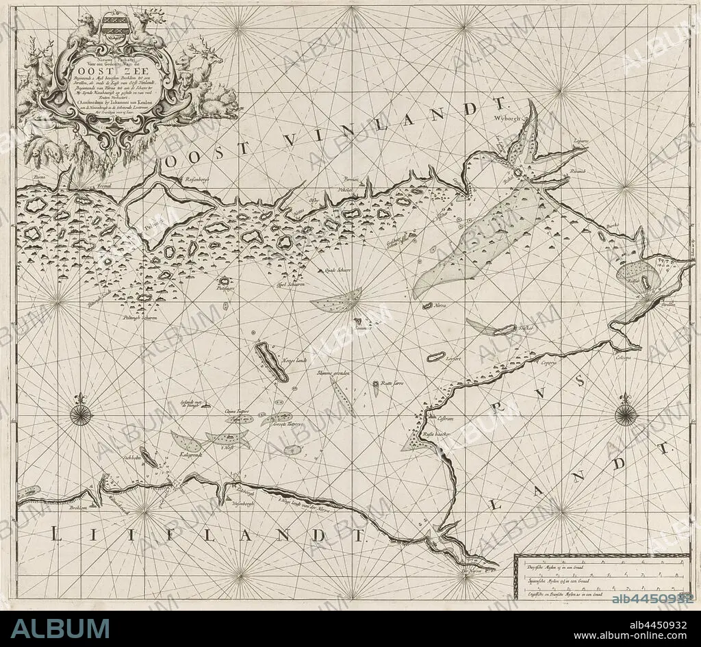
Map of the eastern part of the Gulf of Finland New pass for part of the Baltic Sea starting from 2 Myl west Broklom to a and Strellen, as well as the Coast of East Vinlandt, starting from Parna to the Schans ter Ny. Zynde Naeukeurigh on systems and many errors Verbeetert. (title on object), Map of the eastern part of the Gulf of Finland, with two compass roses, the North is above. Above left a cartouche with the title and address of the publisher, decorated with a weapon, deer, bears and seals. Bottom right the scale in German, Spanish and English or French miles (scale: c. 1: 400 000), beasts of prey, predatory animals: bear, hoofed animals: deer, swimming mammals: seal, Baltic Sea area, Jan Luyken (possibly), Amsterdam, 1681 - 1799, paper, engraving, h 520 mm × w 585 mm.
| Teilen |
|---|
 Pinterest Pinterest |
 Twitter Twitter |
 Facebook Facebook |
 Link kopieren Link kopieren |
 Email Email |
|
Zu einem anderen Lightbox hinzufügen |
|
Zu einem anderen Lightbox hinzufügen |


Haben Sie bereits ein Konto? Anmelden
Sie haben kein Konto? Registrieren
Dieses Bild kaufen.
Nutzung auswählen:

Untertitel:
Siehe automatische Übersetzung
Map of the eastern part of the Gulf of Finland New pass for part of the Baltic Sea starting from 2 Myl west Broklom to a and Strellen, as well as the Coast of East Vinlandt, starting from Parna to the Schans ter Ny. Zynde Naeukeurigh on systems and many errors Verbeetert. (title on object), Map of the eastern part of the Gulf of Finland, with two compass roses, the North is above. Above left a cartouche with the title and address of the publisher, decorated with a weapon, deer, bears and seals. Bottom right the scale in German, Spanish and English or French miles (scale: c. 1: 400 000), beasts of prey, predatory animals: bear, hoofed animals: deer, swimming mammals: seal, Baltic Sea area, Jan Luyken (possibly), Amsterdam, 1681 - 1799, paper, engraving, h 520 mm × w 585 mm
Bildnachweis:
Album / quintlox
Freigaben (Releases):
Model: Nein - Eigentum: Nein
Rechtefragen?
Rechtefragen?
Bildgröße:
6394 x 5572 px | 101.9 MB
Druckgröße:
54.1 x 47.2 cm | 21.3 x 18.6 in (300 dpi)
Schlüsselwörter:
AMSTERDAM • BAER • BRITISCHE • BÄR • DEUTSCH • EDELHIRSCH • ENGLISCH • FINNLAND • GRAVUR • HIRSCH • HUFTIERE • KARTE (KARTHOGRAFIE) • KARTEN • KARTHOGRAPHIE • LANDKARTE • NORDEN • OBJEKT • PAPIER • PLAN (KARTOGRAPHIE) • REHBOCK • ROTWILD • STICH (KUNST) • TIER: REHBOCK • WAFFE • WAFFEN • WILD, ROTWILD
