alb5400279
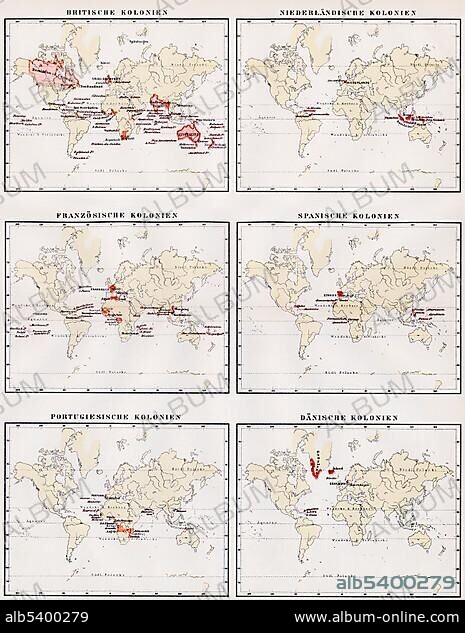
Historic illustration, world maps showing the colonies of Great Britain, Netherlands, France, Spain, Portugal and Denmark, 19th century, Meyers Konversations-Lexikon encyclopedia, 1889, Europe.
| Teilen |
|---|
 Pinterest Pinterest |
 Twitter Twitter |
 Facebook Facebook |
 Link kopieren Link kopieren |
 Email Email |
|
Zu einem anderen Lightbox hinzufügen |
|
Zu einem anderen Lightbox hinzufügen |


Haben Sie bereits ein Konto? Anmelden
Sie haben kein Konto? Registrieren
Dieses Bild kaufen

Untertitel:
Siehe automatische Übersetzung
Historic illustration, world maps showing the colonies of Great Britain, Netherlands, France, Spain, Portugal and Denmark, 19th century, Meyers Konversations-Lexikon encyclopedia, 1889, Europe
Bildnachweis:
Album / ImageBroker / H.-D. Falkenstein
Freigaben (Releases):
Model: Nein - Eigentum: Nein
Rechtefragen?
Rechtefragen?
Bildgröße:
465 x 600 px | 817.4 KB
Druckgröße:
3.9 x 5.1 cm | 1.6 x 2.0 in (300 dpi)
Schlüsselwörter:
BILDER • DÄNEMARK • ENGLAND • GEOGRAFIE • GEOGRAPHIE • GESCHICHTE, NIEDERLANDE • GESCHICHTE, PORTUGAL • HAARLEM, NIEDERLANDE • HOLLAND • ILLUSTRATION • ILLUSTRATIONS • IN GEMAELDEN • INNENRAEUME: IN GEMAELDEN • KADER • KARTE • KARTEN • KOLONIE • LANDSCHAFT NIEDERLANDE • MALEN • MIETSKASERNE • NIEDERLANDE, LANDSCHAFT • NIEDERLANDE: GESCHICHTE • PAPPE • PORTUGAL • SPANIEN • STRASSENKARTE • WELTKARTE • ZEICHNUNGEN • ZEIGEN
