alb1463736
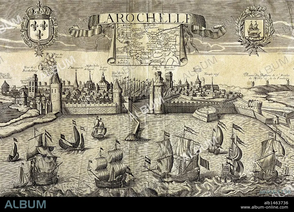
La Rochelle. Map of the city on the Atlantic. Sixteenth-century engraving by Jollain.
| Teilen |
|---|
 Pinterest Pinterest |
 Twitter Twitter |
 Facebook Facebook |
 Link kopieren Link kopieren |
 Email Email |
|
Zu einem anderen Lightbox hinzufügen |
|
Zu einem anderen Lightbox hinzufügen |


Haben Sie bereits ein Konto? Anmelden
Sie haben kein Konto? Registrieren
Dieses Bild kaufen.
Nutzung auswählen:

Untertitel: Siehe automatische Übersetzung
La Rochelle. Map of the city on the Atlantic. Sixteenth-century engraving by Jollain.
La Rochelle. Map of the city on the Atlantic. Sixteenth-century engraving by Jollain.
Bildnachweis: Album / Prisma
Freigaben (Releases): ? Modellfreigabe: Nein - ? Eigentumsfreigabe: Nein
Rechtefragen?
Rechtefragen?
Bildgröße: 4983 × 3345 px | 47.7 MB
Druckgröße: 42.2 × 28.3 cm | 1961.8 × 1316.9 in (300 dpi)
Schlüsselwörter: 16. JAHRHUNDERT • 16. JH. • ABENDLÄNDISCH • ATLANTIK • ATLANTISCHER OZEAN • EINSCHIFFUNG • FRANKREICH • GESCHICHTE • GRAVUR • KARTE (KARTHOGRAFIE) • KARTEN • KARTHOGRAFIE • KARTHOGRAPHIE • KARTOGRAFIE (KARTE) • KARTOGRAPHIE • KUESTE • KÜSTE • LA ROCHELLE • LANDKARTE • MARITIM • MEER • MEERE • NAVEGATION • NAVIGATION • OZEAN • PFLANZE • PFLANZEN • PLAN (KARTOGRAPHIE) • SCHIFF: BELADUNG • SCHIFF: EINSCHIFFUNG • SCHIFFAHRT • SCHIFFFAHRT • SEA • SEESTUECK (GEMAELDE) • STADT • STICH (KUNST) • URBANISMUS • URBANISTIK • VILLA • WESTERN • WESTLICH • WISSENSCH.: KARTOGRAPHIE • ZEITGESCHICHTE
