alb6184816
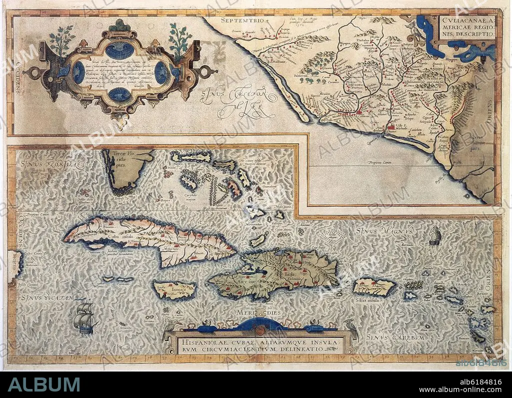
MAPA DE LAS ANTILLAS - 1579 - CARTOGRAFIA SIGLO XVI
 Pinterest
 Twitter
 Facebook
 Link kopieren
 Email
Email


Haben Sie bereits ein Konto? Anmelden
Sie haben kein Konto? Registrieren
Dieses Bild kaufen.
Nutzung auswählen:

Titel:
MAPA DE LAS ANTILLAS - 1579 - CARTOGRAFIA SIGLO XVI
Untertitel:
Siehe automatische Übersetzung
MAP OF THE ANTILLES - 1579 - 16TH CENTURY
Standort:
Bildnachweis:
Album / Oronoz
Freigaben (Releases):
Model: Nein - Eigentum: Nein
Rechtefragen?
Rechtefragen?
Bildgröße:
6071 x 4409 px | 76.6 MB
Druckgröße:
51.4 x 37.3 cm | 20.2 x 14.7 in (300 dpi)
Schlüsselwörter:
