alb3960228
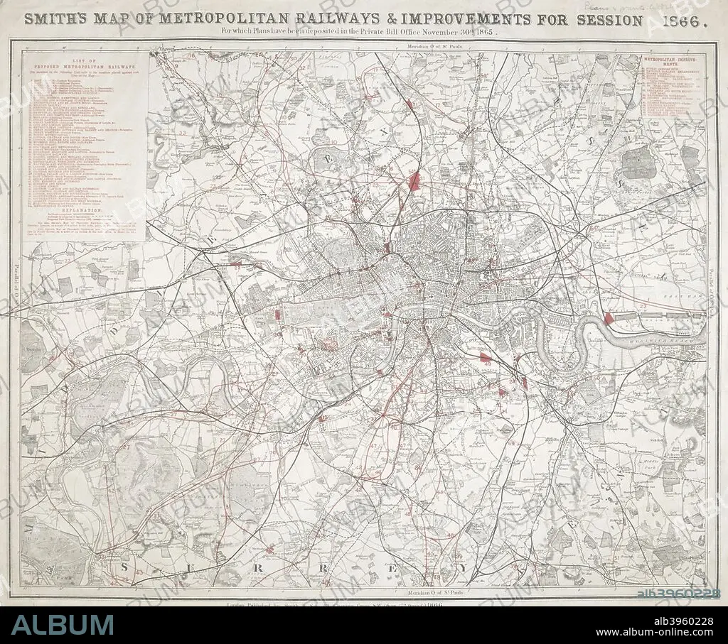
Map of Greater London showing the Metropolitan Railways and improvements in 1866. Artist: Anon
| Teilen |
|---|
 Pinterest Pinterest |
 Twitter Twitter |
 Facebook Facebook |
 Link kopieren Link kopieren |
 Email Email |
|
Zu einem anderen Lightbox hinzufügen |
|
Zu einem anderen Lightbox hinzufügen |


Haben Sie bereits ein Konto? Anmelden
Sie haben kein Konto? Registrieren
Dieses Bild kaufen

Titel:
Map of Greater London showing the Metropolitan Railways and improvements in 1866. Artist: Anon
Untertitel:
Siehe automatische Übersetzung
Map of Greater London showing the Metropolitan Railways and improvements in 1866. With a table inset listing the proposed lines. Completed railways are shown in a firm black line, with those in progress or sanctioned represented by a pecked black line. Proposed new lines are shown in red.
Persönlichkeiten:
Bildnachweis:
Album / The London Archives (City of London)/Heritage Images
Freigaben (Releases):
Model: Nein - Eigentum: Nein
Rechtefragen?
Rechtefragen?
Bildgröße:
2747 x 2290 px | 18.0 MB
Druckgröße:
23.3 x 19.4 cm | 9.2 x 7.6 in (300 dpi)
Schlüsselwörter:
