alb3547306
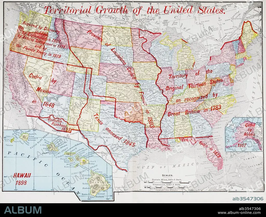
Map from 1898 showing the territorial growth of the United States of America
| Teilen |
|---|
 Pinterest Pinterest |
 Twitter Twitter |
 Facebook Facebook |
 Link kopieren Link kopieren |
 Email Email |
|
Zu einem anderen Lightbox hinzufügen |
|
Zu einem anderen Lightbox hinzufügen |


Haben Sie bereits ein Konto? Anmelden
Sie haben kein Konto? Registrieren
Dieses Bild kaufen.
Nutzung auswählen:

Titel: Map from 1898 showing the territorial growth of the United States of America
Untertitel: Siehe automatische Übersetzung
Map from 1898 showing the territorial growth of the United States of America. From The History of Our Country, published 1900
Map from 1898 showing the territorial growth of the United States of America. From The History of Our Country, published 1900
Bildnachweis: Album / Universal Images Group / Universal History Archive
Freigaben (Releases): ? Modellfreigabe: Nein - ? Eigentumsfreigabe: Nein
Rechtefragen?
Rechtefragen?
Bildgröße: 4783 × 3664 px | 50.1 MB
Druckgröße: 40.5 × 31.0 cm | 1883.1 × 1442.5 in (300 dpi)
Schlüsselwörter: AMERIKA • AMERIKA, KONTINENT • AMERIKANERIN • AMERIKANISCH (US) • AMERIKANISCH • ANNEXION • DAENISCH • DREIZEHN • DÄNEMARK • EINKAEUFE • ENGLAND • GEOGRAFIE • GEOGRAPHIE • GESCHICHTE • GROSSBRITANNIEN • ILLUSTRATION • ILLUSTRATIONS • KARTE (KARTHOGRAFIE) • KARTE • KARTEN • KARTHOGRAPHIE • KONTINENT: AMERIKA • KÖNIGREICH • LANDKARTE • MEXIKANERIN • MEXIKANISCH • ORIGINELL • PLAN (KARTOGRAPHIE) • RUSSISCH • SPANIEN • US-AMERIKANISCH • USA • USA-VEREINIGE STAATEN • WACHSTUM • ZEITGESCHICHTE
