alb5533484
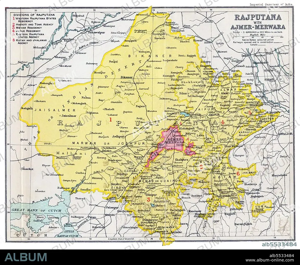
India: Imperial Gazetteer of India map of 'Rajputana with Ajmer-Merwara', Bartholomew,1909.
| Teilen |
|---|
 Pinterest Pinterest |
 Twitter Twitter |
 Facebook Facebook |
 Link kopieren Link kopieren |
 Email Email |
|
Zu einem anderen Lightbox hinzufügen |
|
Zu einem anderen Lightbox hinzufügen |


Haben Sie bereits ein Konto? Anmelden
Sie haben kein Konto? Registrieren
Dieses Bild kaufen

Titel:
India: Imperial Gazetteer of India map of 'Rajputana with Ajmer-Merwara', Bartholomew,1909.
Untertitel:
Siehe automatische Übersetzung
Rajputana (Hindi: ????????? ) was the name adopted by British government for its dependencies in the region of present-day Indian state of Rajasthan. Rajputana included 18 princely states, two chiefships and the British district of Ajmer-Merwara. This British official term remained official till its replacement by Rajasthan in the constitution of 1949.
Bildnachweis:
Album / David Henley/Pictures from History/Universal Images Group
Freigaben (Releases):
Model: Nein - Eigentum: Nein
Rechtefragen?
Rechtefragen?
Bildgröße:
4500 x 3740 px | 48.2 MB
Druckgröße:
38.1 x 31.7 cm | 15.0 x 12.5 in (300 dpi)
Schlüsselwörter:
