alb9083455
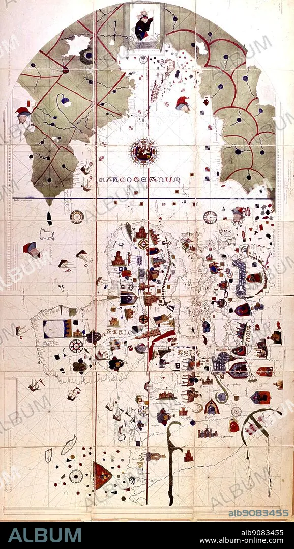
The earliest map showing both Old and New Worlds, drawn in 1500 by Juan de la Cosa, who sailed with Columbus on the second voyage. Unknown lands are coloured the traditional green.
| Teilen |
|---|
 Pinterest Pinterest |
 Twitter Twitter |
 Facebook Facebook |
 Link kopieren Link kopieren |
 Email Email |
|
Zu einem anderen Lightbox hinzufügen |
|
Zu einem anderen Lightbox hinzufügen |


Haben Sie bereits ein Konto? Anmelden
Sie haben kein Konto? Registrieren
Dieses Bild kaufen.
Nutzung auswählen:

Untertitel: Siehe automatische Übersetzung
The earliest map showing both Old and New Worlds, drawn in 1500 by Juan de la Cosa, who sailed with Columbus on the second voyage. Unknown lands are coloured the traditional green.
The earliest map showing both Old and New Worlds, drawn in 1500 by Juan de la Cosa, who sailed with Columbus on the second voyage. Unknown lands are coloured the traditional green.
Bildnachweis: Album / TopFoto
Freigaben (Releases): ? Modellfreigabe: Nein - ? Eigentumsfreigabe: Nein
Rechtefragen?
Rechtefragen?
Bildgröße: 2243 × 3975 px | 25.5 MB
Druckgröße: 19.0 × 33.7 cm | 883.1 × 1565.0 in (300 dpi)
Schlüsselwörter: ENTDECKUNG • ERKUNDUNG • GESCHICHTE, PORTUGAL • PORTUGAL • SPANIEN
