alb4088250
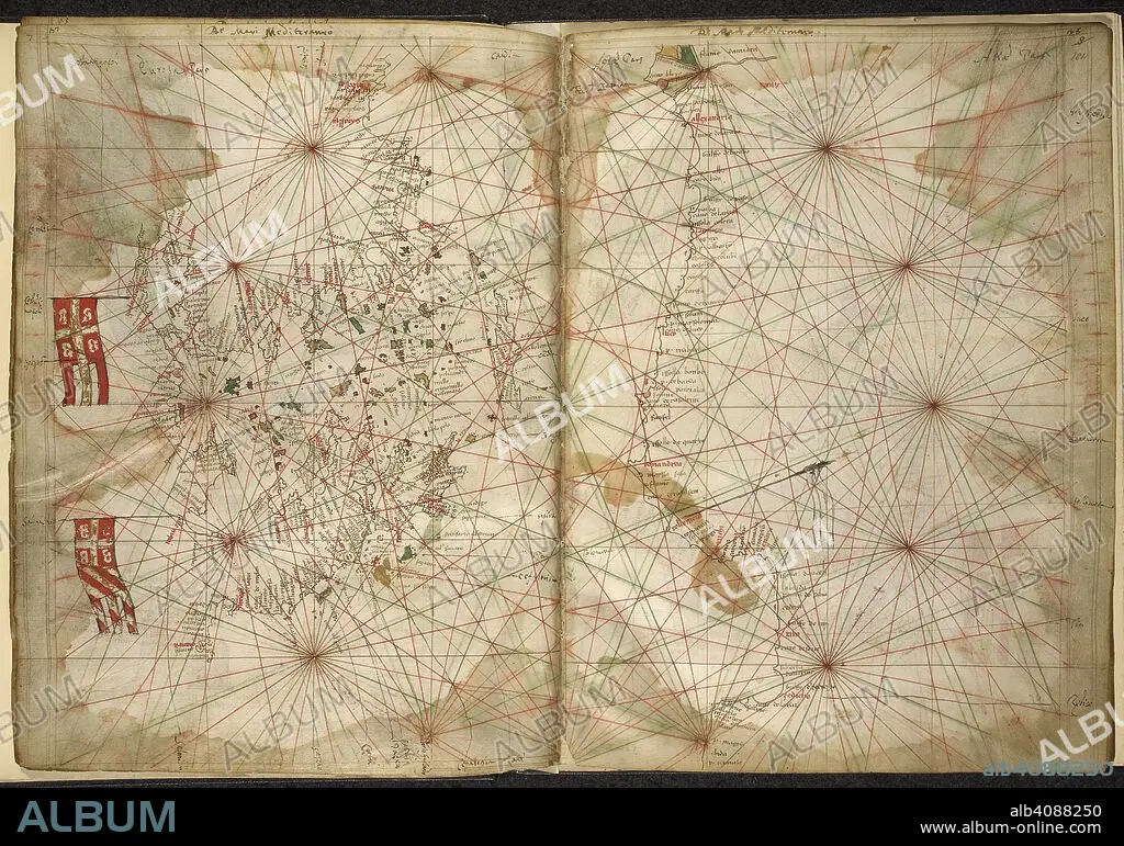
PIETRO VESCONTE. Portolan chart of the Eastern Mediterranean, with Greece, Turkey, the Black Sea, and Crete. Maps of the Liber Secretorum Fidelium Crucis. Italy (Venice); circa 1320-1325. Source: Add. 27376*, ff.183v-184. Language: Latin.
| Teilen |
|---|
 Pinterest Pinterest |
 Twitter Twitter |
 Facebook Facebook |
 Link kopieren Link kopieren |
 Email Email |
|
Zu einem anderen Lightbox hinzufügen |
|
Zu einem anderen Lightbox hinzufügen |


Haben Sie bereits ein Konto? Anmelden
Sie haben kein Konto? Registrieren
Dieses Bild kaufen.
Nutzung auswählen:

Autor: PIETRO VESCONTE
Untertitel: Siehe automatische Übersetzung
Portolan chart of the Eastern Mediterranean, with Greece, Turkey, the Black Sea, and Crete. Maps of the Liber Secretorum Fidelium Crucis. Italy (Venice); circa 1320-1325. Source: Add. 27376*, ff.183v-184. Language: Latin.
Portolan chart of the Eastern Mediterranean, with Greece, Turkey, the Black Sea, and Crete. Maps of the Liber Secretorum Fidelium Crucis. Italy (Venice); circa 1320-1325. Source: Add. 27376*, ff.183v-184. Language: Latin.
Bildnachweis: Album / British Library
Freigaben (Releases): ? Modellfreigabe: Nein - ? Eigentumsfreigabe: Nein
Rechtefragen?
Rechtefragen?
Bildgröße: 6846 × 4798 px | 94.0 MB
Druckgröße: 58.0 × 40.6 cm | 2695.3 × 1889.0 in (300 dpi)
Schlüsselwörter: 14. JAHRHUNDERT • 14. JH. • DOKUMENT • EUROPA • FARBE • FARBEN • FARBIG • GREECE • GRIECHENLAND • KARTE (KARTHOGRAFIE) • KARTE • KARTEN • KARTHOGRAFIE • KARTHOGRAPHIE • KARTOGRAFIE (KARTE) • KARTOGRAPHIE • LANDKARTE • MITTELMEER • PIETRO VESCONTE • PLAN (KARTOGRAPHIE) • TÜRKEI • WISSENSCH.: KARTOGRAPHIE
