alb1960835
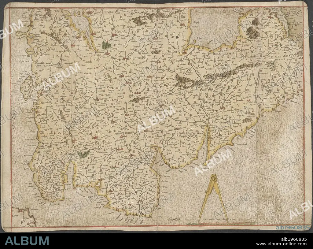
England. The Mercator atlas of Europe. 1570-1572. Map of England. Image taken from The Mercator atlas of Europe. Originally published/produced in 1570-1572. . Source: Maps.C.29.c.13.
| Teilen |
|---|
 Pinterest Pinterest |
 Twitter Twitter |
 Facebook Facebook |
 Link kopieren Link kopieren |
 Email Email |
|
Zu einem anderen Lightbox hinzufügen |
|
Zu einem anderen Lightbox hinzufügen |


Haben Sie bereits ein Konto? Anmelden
Sie haben kein Konto? Registrieren
Dieses Bild kaufen.
Nutzung auswählen:

Untertitel:
Siehe automatische Übersetzung
England. The Mercator atlas of Europe. 1570-1572. Map of England. Image taken from The Mercator atlas of Europe. Originally published/produced in 1570-1572. . Source: Maps.C.29.c.13.
Bildnachweis:
Album / British Library
Freigaben (Releases):
Model: Nein - Eigentum: Nein
Rechtefragen?
Rechtefragen?
Bildgröße:
9509 x 7064 px | 192.2 MB
Druckgröße:
80.5 x 59.8 cm | 31.7 x 23.5 in (300 dpi)
Schlüsselwörter:
