alb5413540
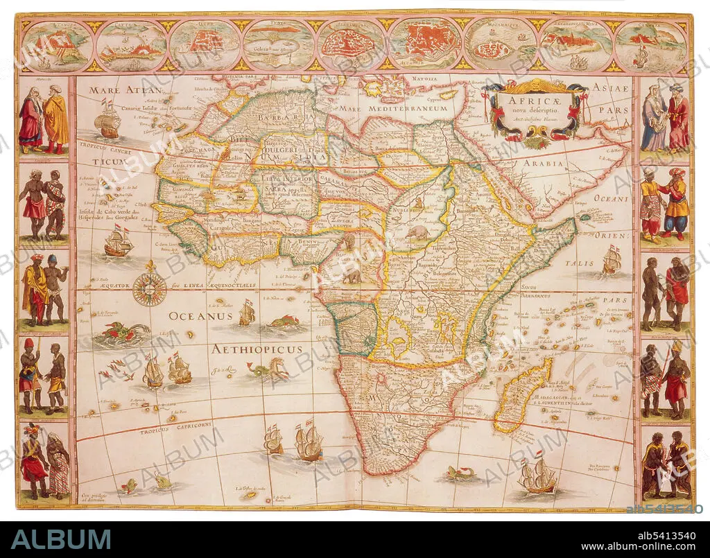
Joan Blaeu, Africa Map, 17th Century
| Teilen |
|---|
 Pinterest Pinterest |
 Twitter Twitter |
 Facebook Facebook |
 Link kopieren Link kopieren |
 Email Email |
|
Zu einem anderen Lightbox hinzufügen |
|
Zu einem anderen Lightbox hinzufügen |


Haben Sie bereits ein Konto? Anmelden
Sie haben kein Konto? Registrieren
Dieses Bild kaufen.
Nutzung auswählen:

Titel:
Joan Blaeu, Africa Map, 17th Century
Untertitel:
Siehe automatische Übersetzung
Africa is the world's second largest and second most-populous continent. At about 11.7 million square miles including adjacent islands, it covers 6% of Earth's total surface area and 20% of its land area. The continent is surrounded by the Mediterranean Sea to the north, the Isthmus of Suez and the Red Sea to the northeast, the Indian Ocean to the southeast and the Atlantic Ocean to the west. The continent includes Madagascar and various archipelagos. Joan Blaeu (1596-1673) was a Dutch cartographer, the son of cartographer Willem Blaeu. In 1635 they published the Atlas Novus (full title: Theatrum orbis terrarum, sive, Atlas novus) in two volumes. The Atlas Maior is the final version of Joan Blaeu's atlas, published in Amsterdam between 1662 and 1672, in Latin, French, Dutch, German and Spanish, containing 594 maps and around 3,000 pages of text.
Bildnachweis:
Album / Science Source
Freigaben (Releases):
Bildgröße:
4350 x 3194 px | 39.8 MB
Druckgröße:
36.8 x 27.0 cm | 14.5 x 10.6 in (300 dpi)
Schlüsselwörter:
