alb8368726
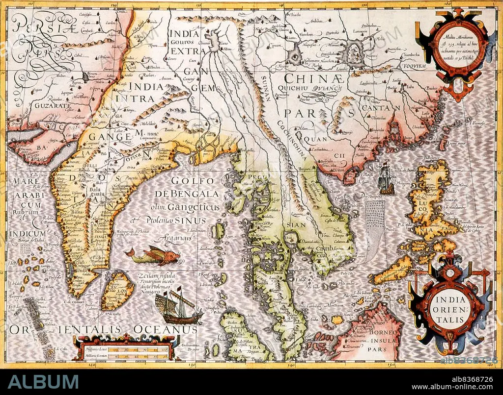
India Orientalis: Early 17th century map of India beyond the Ganges including Southeast Asia and part of China. Published by Jodocus Hondius (Amsterdam, c. 1606) from an original by Gerard Mercator
| Teilen |
|---|
 Pinterest Pinterest |
 Twitter Twitter |
 Facebook Facebook |
 Link kopieren Link kopieren |
 Email Email |
|
Zu einem anderen Lightbox hinzufügen |
|
Zu einem anderen Lightbox hinzufügen |


Haben Sie bereits ein Konto? Anmelden
Sie haben kein Konto? Registrieren
Dieses Bild kaufen.
Nutzung auswählen:

Titel: India Orientalis: Early 17th century map of India beyond the Ganges including Southeast Asia and part of China. Published by Jodocus Hondius (Amsterdam, c. 1606) from an original by Gerard Mercator
Untertitel: Siehe automatische Übersetzung
Jodocus Hondius (Dutch name: Joost de Hondt) (1563 1612) was a Flemish engraver and cartographer. He helped establish Amsterdam as the center of cartography in Europe in the 17th century.
Jodocus Hondius (Dutch name: Joost de Hondt) (1563 1612) was a Flemish engraver and cartographer. He helped establish Amsterdam as the center of cartography in Europe in the 17th century.
Bildnachweis: Album / Universal Images Group / Pictures From History
Freigaben (Releases): ? Modellfreigabe: Nein - ? Eigentumsfreigabe: Nein
Rechtefragen?
Rechtefragen?
Bildgröße: 4875 × 3586 px | 50.0 MB
Druckgröße: 41.3 × 30.4 cm | 1919.3 × 1411.8 in (300 dpi)
Schlüsselwörter: 17. JAHRHUNDERT • 17. JH. • ASIEN • ASIEN, KONTINENT • HOLLAENDISCH • HOLLAND • KARTE (KARTHOGRAFIE) • KARTE • KARTEN • KARTHOGRAFIE • KARTHOGRAPHIE • KARTOGRAFIE (KARTE) • KARTOGRAPH • KARTOGRAPHIE • KLEIDUNG, HOLLAENDISCH • KONTINENT, ASIEN • LANDKARTE • PLAN (KARTOGRAPHIE) • WISSENSCH.: KARTOGRAPHIE
