alb4057709
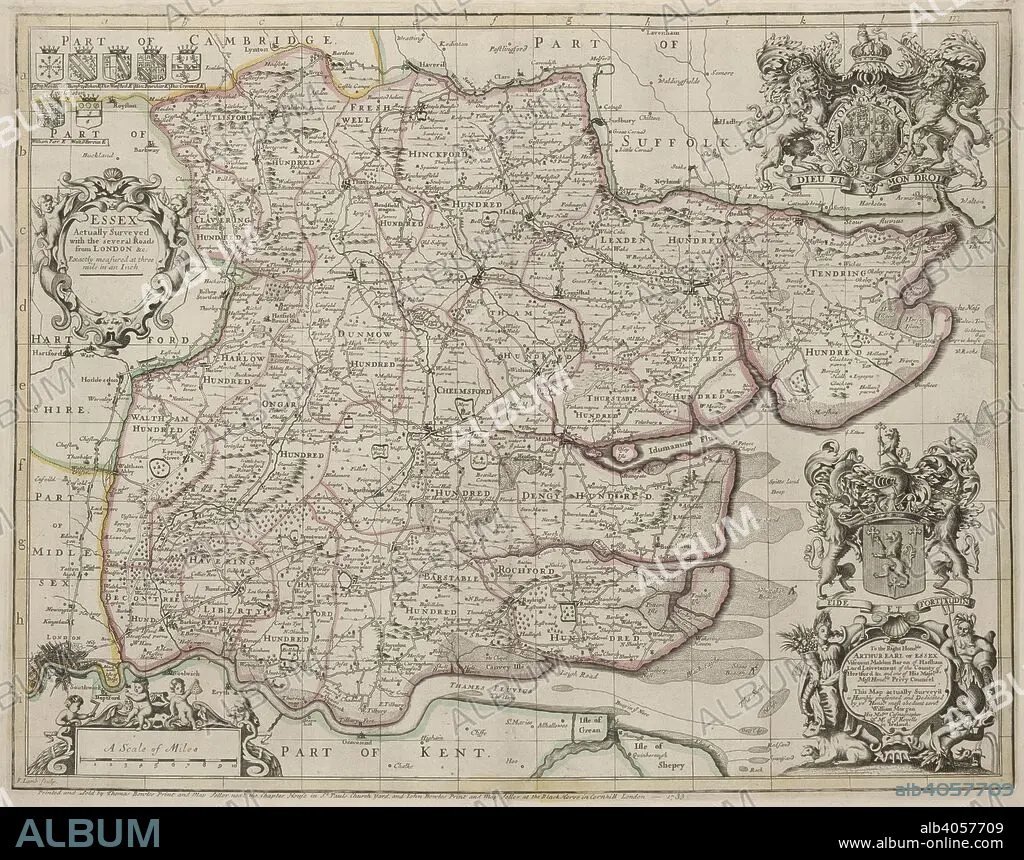
A map of Essex. Essex, actually surveyed, with the several Roads from London, &c. ... by John Ogilby and Wilm Morgan, His Majtles Cosmographers. To the Right Honoble Arthur Earl of Essex ... this Map actually survey'd is ... dedicated by ... William Morgan, etc. London : Printed and sold by Thomas Bowles and John Bowles, 1733. Source: Maps K.Top.13.4. Language: English.
| Teilen |
|---|
 Pinterest Pinterest |
 Twitter Twitter |
 Facebook Facebook |
 Link kopieren Link kopieren |
 Email Email |
|
Zu einem anderen Lightbox hinzufügen |
|
Zu einem anderen Lightbox hinzufügen |


Haben Sie bereits ein Konto? Anmelden
Sie haben kein Konto? Registrieren
Dieses Bild kaufen.
Nutzung auswählen:

Autor:
Untertitel:
Siehe automatische Übersetzung
A map of Essex. Essex, actually surveyed, with the several Roads from London, &c. ... by John Ogilby and Wilm Morgan, His Majtles Cosmographers. To the Right Honoble Arthur Earl of Essex ... this Map actually survey'd is ... dedicated by ... William Morgan, etc. London : Printed and sold by Thomas Bowles and John Bowles, 1733. Source: Maps K.Top.13.4. Language: English.
Bildnachweis:
Album / British Library
Freigaben (Releases):
Bildgröße:
6738 x 5310 px | 102.4 MB
Druckgröße:
57.0 x 45.0 cm | 22.5 x 17.7 in (300 dpi)
Schlüsselwörter:
