alb1643906
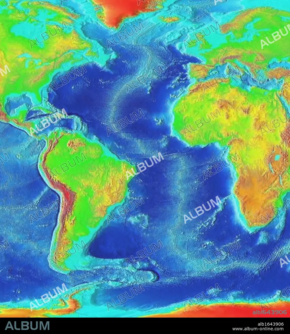
Satellite thermographic image of the Atlantic Ocean showing coldest areas in Arctic, Antarctic and high Andes as bright orange. National Oceanic and Atmospheric Administration (NOAA). Science.
| Teilen |
|---|
 Pinterest Pinterest |
 Twitter Twitter |
 Facebook Facebook |
 Link kopieren Link kopieren |
 Email Email |
|
Zu einem anderen Lightbox hinzufügen |
|
Zu einem anderen Lightbox hinzufügen |


Haben Sie bereits ein Konto? Anmelden
Sie haben kein Konto? Registrieren
Dieses Bild kaufen.
Nutzung auswählen:

Untertitel: Siehe automatische Übersetzung
Satellite thermographic image of the Atlantic Ocean showing coldest areas in Arctic, Antarctic and high Andes as bright orange. National Oceanic and Atmospheric Administration (NOAA). Science
Satellite thermographic image of the Atlantic Ocean showing coldest areas in Arctic, Antarctic and high Andes as bright orange. National Oceanic and Atmospheric Administration (NOAA). Science
Bildnachweis: Album / Universal History Archive/Universal Images Group
Freigaben (Releases): ? Modellfreigabe: Nein - ? Eigentumsfreigabe: Nein
Rechtefragen?
Rechtefragen?
Bildgröße: 4005 × 4388 px | 50.3 MB
Druckgröße: 33.9 × 37.2 cm | 1576.8 × 1727.6 in (300 dpi)
Schlüsselwörter: APFELSINE • ARKTIS • ATLANTIK • ATLANTISCHER OZEAN • BEHOERDE • BEHÖRDE • HOCH • MEER • MEERE • NORDPOL • OCEANIC • ORANGE • OZEAN • REGIERUNG • SATELLIT • SEA • SEESTUECK (GEMAELDE) • VERWALTUNG • WISSENSCHAFT • WISSENSCHAFTEN
