alb3547870
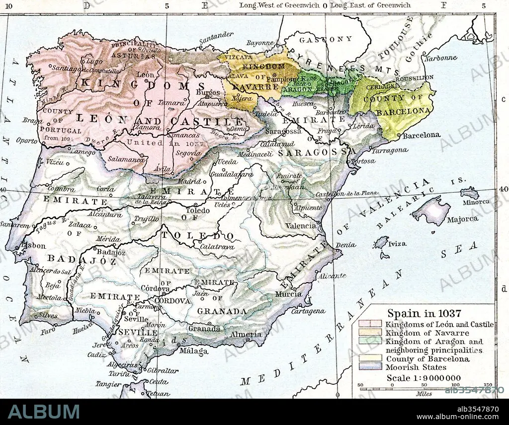
Map of Spain in 1037 showing the kingdoms of León and Castile, kingdom of Navarre, kingdom of Aragon and neighbouring principalities, county of Barcelona and Moorish states
| Teilen |
|---|
 Pinterest Pinterest |
 Twitter Twitter |
 Facebook Facebook |
 Link kopieren Link kopieren |
 Email Email |
|
Zu einem anderen Lightbox hinzufügen |
|
Zu einem anderen Lightbox hinzufügen |


Haben Sie bereits ein Konto? Anmelden
Sie haben kein Konto? Registrieren
Dieses Bild kaufen.
Nutzung auswählen:

Titel:
Map of Spain in 1037 showing the kingdoms of León and Castile, kingdom of Navarre, kingdom of Aragon and neighbouring principalities, county of Barcelona and Moorish states
Untertitel:
Siehe automatische Übersetzung
Map of Spain in 1037 showing the kingdoms of León and Castile, kingdom of Navarre, kingdom of Aragon and neighbouring principalities, county of Barcelona and Moorish states. From Historical Atlas, published 1923.
Bildnachweis:
Album / Universal Images Group / Universal History Archive
Freigaben (Releases):
Bildgröße:
4843 x 3797 px | 52.6 MB
Druckgröße:
41.0 x 32.1 cm | 16.1 x 12.7 in (300 dpi)
Schlüsselwörter:
11. JAHRHUNDERT • 11. JH. • BARCELONA • GEOGRAFIE • GEOGRAPHIE • GESCHICHTE • KARTE (KARTHOGRAFIE) • KARTE • KARTEN • KARTHOGRAPHIE • KÖNIGREICH • LAENDER • LANDKARTE • LÄNDER • PLAN (KARTOGRAPHIE) • SPANIEN • ZEITGESCHICHTE
