alb4060562
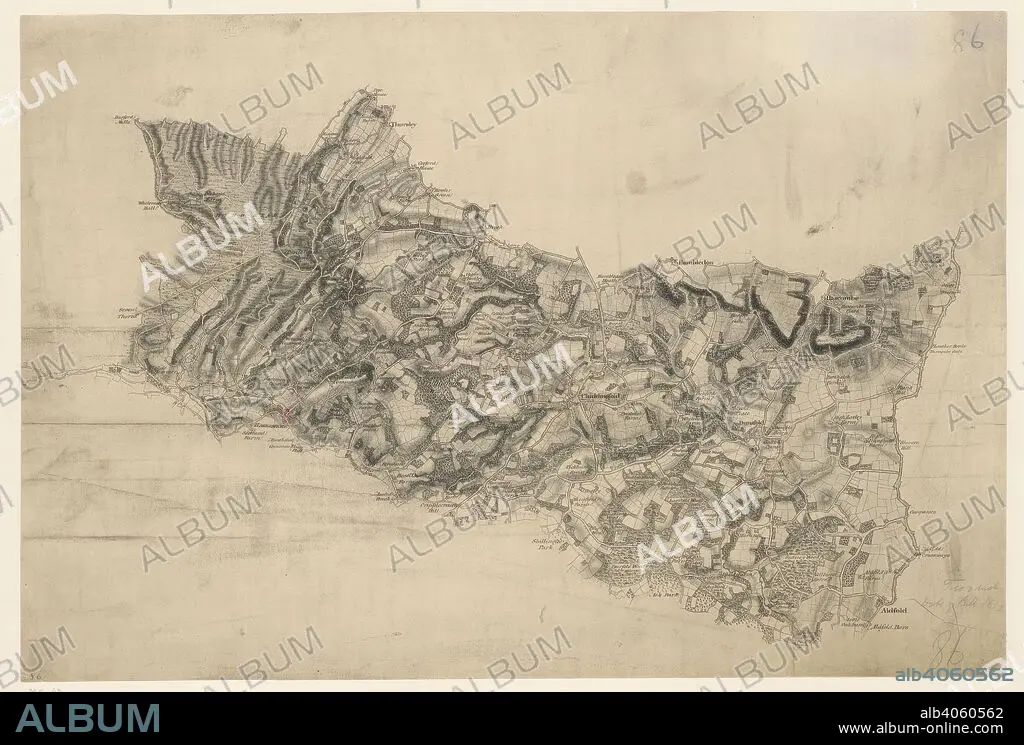
THOMAS BUDGEN. A map of Chiddingfold. A turnpike road, coloured ochre yellow, forms a boundary from Hascombe at the top right of the map to 'Aldfold' at the bottom. Common land and dense woodland dominate the region to the left around Hindhead Valley and the Devil's Punchbowl.Commonland is indicated by open dotting. Woods and trees could provide hindrance or cover for the movement of a regiment, so these are recorded in painstaking detail. Individual trees are depicted with a small vertical stem and a shadow at the base. There are also more general representations of groups of treetops. Chiddingfold is a village and civil parish in the heart of The Weald in the Waverley district of Surrey, England. . (Map of Chiddingfold.). 1810. Pencil and ink on paper. Map scale ratio: 2'' : Mile (1 : 31680). Source: OSD 86/2.
| Teilen |
|---|
 Pinterest Pinterest |
 Twitter Twitter |
 Facebook Facebook |
 Link kopieren Link kopieren |
 Email Email |
|
Zu einem anderen Lightbox hinzufügen |
|
Zu einem anderen Lightbox hinzufügen |


Haben Sie bereits ein Konto? Anmelden
Sie haben kein Konto? Registrieren
Dieses Bild kaufen.
Nutzung auswählen:

Autor:
Untertitel:
Siehe automatische Übersetzung
A map of Chiddingfold. A turnpike road, coloured ochre yellow, forms a boundary from Hascombe at the top right of the map to 'Aldfold' at the bottom. Common land and dense woodland dominate the region to the left around Hindhead Valley and the Devil's Punchbowl.Commonland is indicated by open dotting. Woods and trees could provide hindrance or cover for the movement of a regiment, so these are recorded in painstaking detail. Individual trees are depicted with a small vertical stem and a shadow at the base. There are also more general representations of groups of treetops. Chiddingfold is a village and civil parish in the heart of The Weald in the Waverley district of Surrey, England. . (Map of Chiddingfold.). 1810. Pencil and ink on paper. Map scale ratio: 2'' : Mile (1 : 31680). Source: OSD 86/2.
Bildnachweis:
Album / British Library
Freigaben (Releases):
Bildgröße:
11545 x 7798 px | 257.6 MB
Druckgröße:
97.7 x 66.0 cm | 38.5 x 26.0 in (300 dpi)
Schlüsselwörter:
