alb4074047
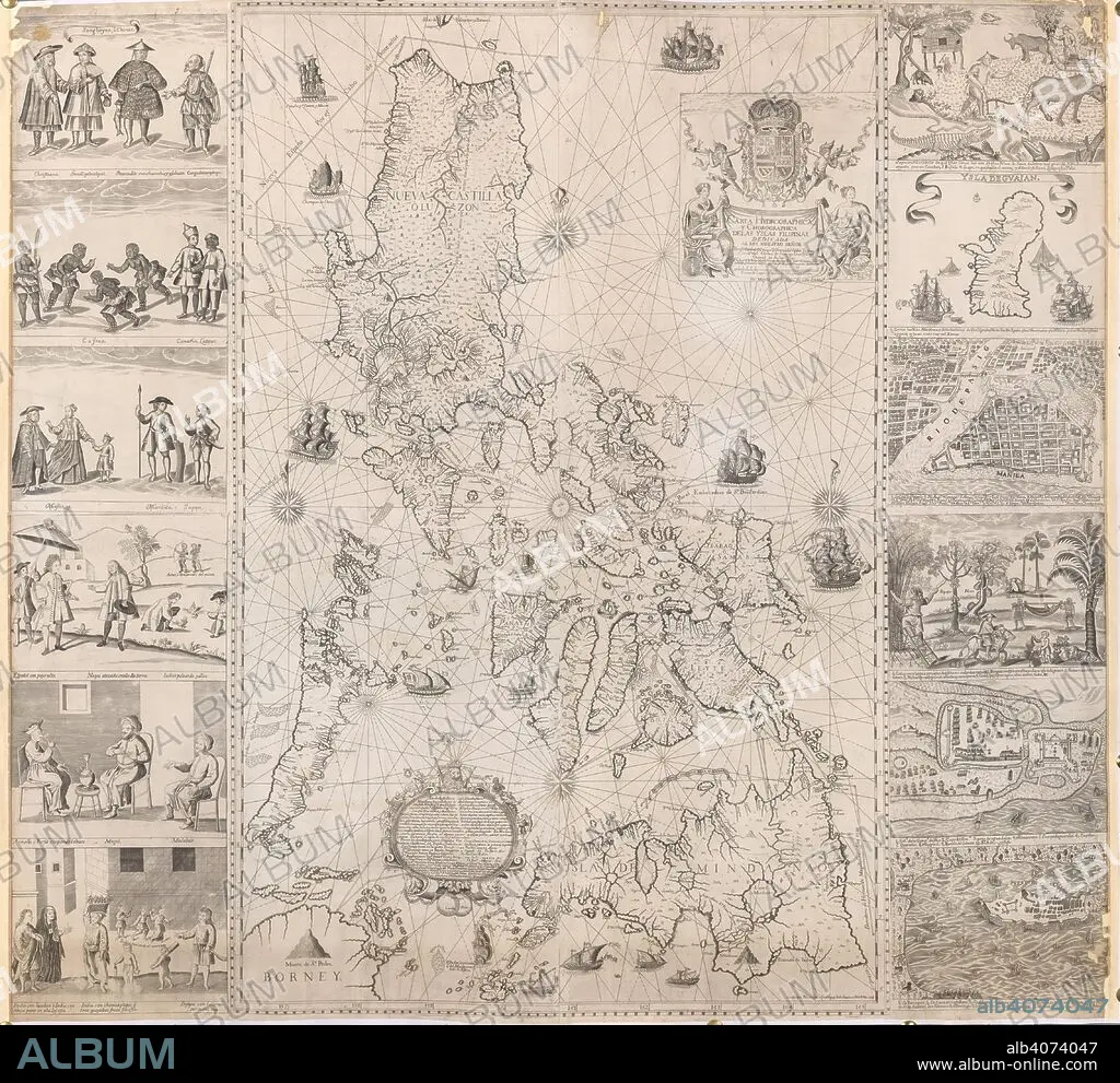
A map of the Philippine Islands with twelve marginal vignettes of illustrations of life in the Philippine Islands and plans of Guam, Cavite, Zamboanga and Manila . Carta Hydrographica, y Chorographica delas Yslas Filipinas. Manila, 1734. Source: Maps K.Top.116.37.
| Teilen |
|---|
 Pinterest Pinterest |
 Twitter Twitter |
 Facebook Facebook |
 Link kopieren Link kopieren |
 Email Email |
|
Zu einem anderen Lightbox hinzufügen |
|
Zu einem anderen Lightbox hinzufügen |


Haben Sie bereits ein Konto? Anmelden
Sie haben kein Konto? Registrieren
Dieses Bild kaufen

Untertitel:
Siehe automatische Übersetzung
A map of the Philippine Islands with twelve marginal vignettes of illustrations of life in the Philippine Islands and plans of Guam, Cavite, Zamboanga and Manila . Carta Hydrographica, y Chorographica delas Yslas Filipinas. Manila, 1734. Source: Maps K.Top.116.37.
Persönlichkeiten:
Bildnachweis:
Album / British Library
Freigaben (Releases):
Model: Nein - Eigentum: Nein
Rechtefragen?
Rechtefragen?
Bildgröße:
4550 x 4170 px | 54.3 MB
Druckgröße:
38.5 x 35.3 cm | 15.2 x 13.9 in (300 dpi)
Schlüsselwörter:
