alb3846632
West Mata Volcano, Bathymetric Map
| Teilen |
|---|
 Pinterest Pinterest |
 Twitter Twitter |
 Facebook Facebook |
 Link kopieren Link kopieren |
 Email Email |
|
Zu einem anderen Lightbox hinzufügen |
|
Zu einem anderen Lightbox hinzufügen |


Haben Sie bereits ein Konto? Anmelden
Sie haben kein Konto? Registrieren
Dieses Bild kaufen.
Nutzung auswählen:

Titel: West Mata Volcano, Bathymetric Map
Untertitel: Siehe automatische Übersetzung
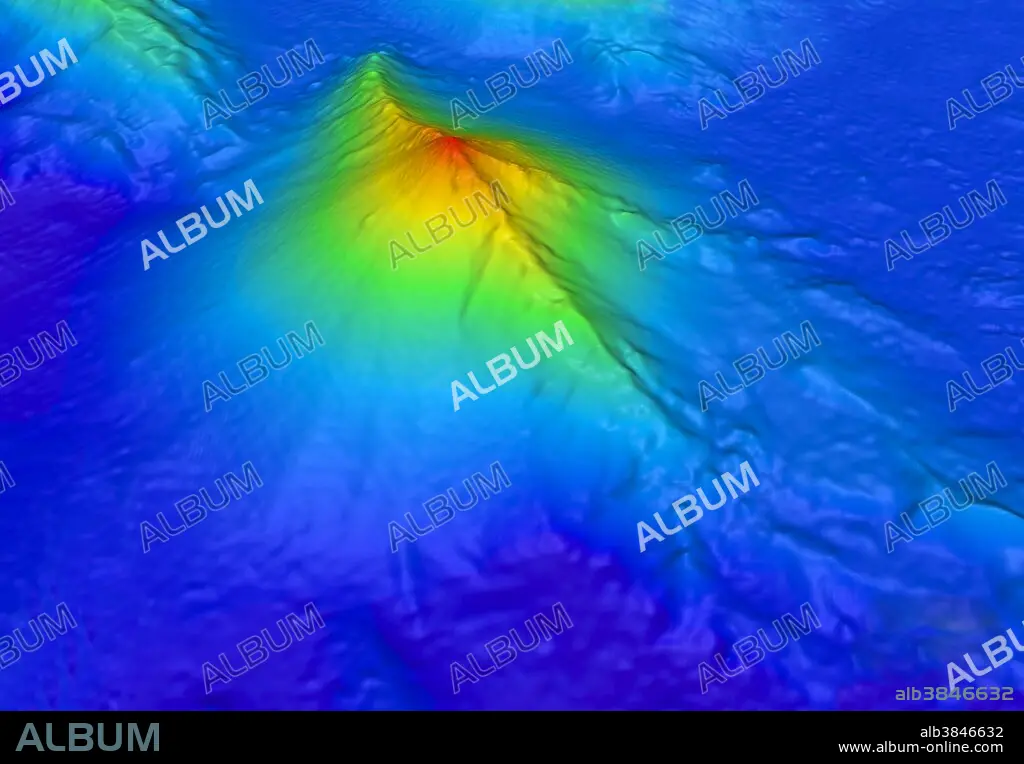
The West Mata volcano was discovered in May 2009 nearly 4,000 feet below the surface of the Pacific Ocean, in an area bounded by Fiji, Tonga and Samoa. It is the deepest erupting volcano discovered to date. In this bathymetric map, the summit of West Mata is shown in red, nearly a mile below the ocean surface (1,165 meters / 3,882 feet); the base, shown in blue, descends to nearly two miles (3,000 meters / 9,842 feet) deep. Eruptions occurred at several places along the summit, in an area about 100 yards. The volcano has a six-mile-long rift zone running along its spine in a SW/NE orientation.
The West Mata volcano was discovered in May 2009 nearly 4,000 feet below the surface of the Pacific Ocean, in an area bounded by Fiji, Tonga and Samoa. It is the deepest erupting volcano discovered to date. In this bathymetric map, the summit of West Mata is shown in red, nearly a mile below the ocean surface (1,165 meters / 3,882 feet); the base, shown in blue, descends to nearly two miles (3,000 meters / 9,842 feet) deep. Eruptions occurred at several places along the summit, in an area about 100 yards. The volcano has a six-mile-long rift zone running along its spine in a SW/NE orientation.
Bildnachweis: Album / NOAA/Science Source
Freigaben (Releases): ? Modellfreigabe: Nein - ? Eigentumsfreigabe: Nein
Rechtefragen?
Rechtefragen?
Bildgröße: 6912 × 4800 px | 94.9 MB
Druckgröße: 58.5 × 40.6 cm | 2721.3 × 1889.8 in (300 dpi)
Schlüsselwörter: AKTIV • MEER • MEERE • OZEAN • PAZIFIK • PAZIFISCHR OZEAN • SEA • SEESTUECK (GEMAELDE) • TOPOGRAPHIE • VULKAN
