alb3793708
Earth, DSCOVR Satellite View
| Teilen |
|---|
 Pinterest Pinterest |
 Twitter Twitter |
 Facebook Facebook |
 Link kopieren Link kopieren |
 Email Email |
|
Zu einem anderen Lightbox hinzufügen |
|
Zu einem anderen Lightbox hinzufügen |


Haben Sie bereits ein Konto? Anmelden
Sie haben kein Konto? Registrieren
Dieses Bild kaufen.
Nutzung auswählen:

Titel: Earth, DSCOVR Satellite View
Untertitel: Siehe automatische Übersetzung
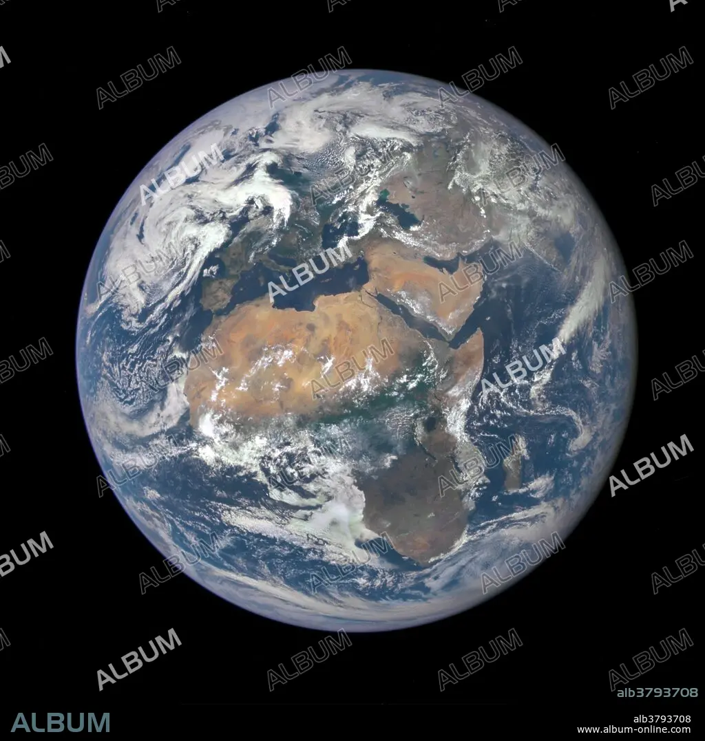
The image, taken from a vantage point one million miles from Earth, was one of the first taken by the Earth Polychromatic Imaging Camera (EPIC) on NASA's Deep Space Climate Observatory (DSCOVR) satellite. Africa occupies most of the view, with Europe to the North and the Arabian Peninsula and Central Asia to the East. The photographic-quality color image was generated by combining three separate images of the entire Earth taken a few minutes apart. The camera takes a series of 10 images using different narrowband filters -- from ultraviolet to near infrared -- to produce a variety of science products. The red, green and blue channel images are used in these Earth images.
The image, taken from a vantage point one million miles from Earth, was one of the first taken by the Earth Polychromatic Imaging Camera (EPIC) on NASA's Deep Space Climate Observatory (DSCOVR) satellite. Africa occupies most of the view, with Europe to the North and the Arabian Peninsula and Central Asia to the East. The photographic-quality color image was generated by combining three separate images of the entire Earth taken a few minutes apart. The camera takes a series of 10 images using different narrowband filters -- from ultraviolet to near infrared -- to produce a variety of science products. The red, green and blue channel images are used in these Earth images.
Bildnachweis: Album / NASA/Science Source
Freigaben (Releases): ? Modellfreigabe: Nein - ? Eigentumsfreigabe: Nein
Rechtefragen?
Rechtefragen?
Bildgröße: 3000 × 3000 px | 25.7 MB
Druckgröße: 25.4 × 25.4 cm | 1181.1 × 1181.1 in (300 dpi)
Schlüsselwörter: AFRIKA • ASTRONOMIE • GLOBUS • LUFTAUFNAHME • OBSERVATORIUM • PLANET ALLE • PLANET • PLANETARIUM • STERNWARTE • WELT • WELTKUGEL • WELTRAUM • WISSENSCH.: ASTRONOMIE
