alb3793188
Strait of Dover
| Teilen |
|---|
 Pinterest Pinterest |
 Twitter Twitter |
 Facebook Facebook |
 Link kopieren Link kopieren |
 Email Email |
|
Zu einem anderen Lightbox hinzufügen |
|
Zu einem anderen Lightbox hinzufügen |


Haben Sie bereits ein Konto? Anmelden
Sie haben kein Konto? Registrieren
Dieses Bild kaufen.
Nutzung auswählen:

Titel: Strait of Dover
Untertitel: Siehe automatische Übersetzung
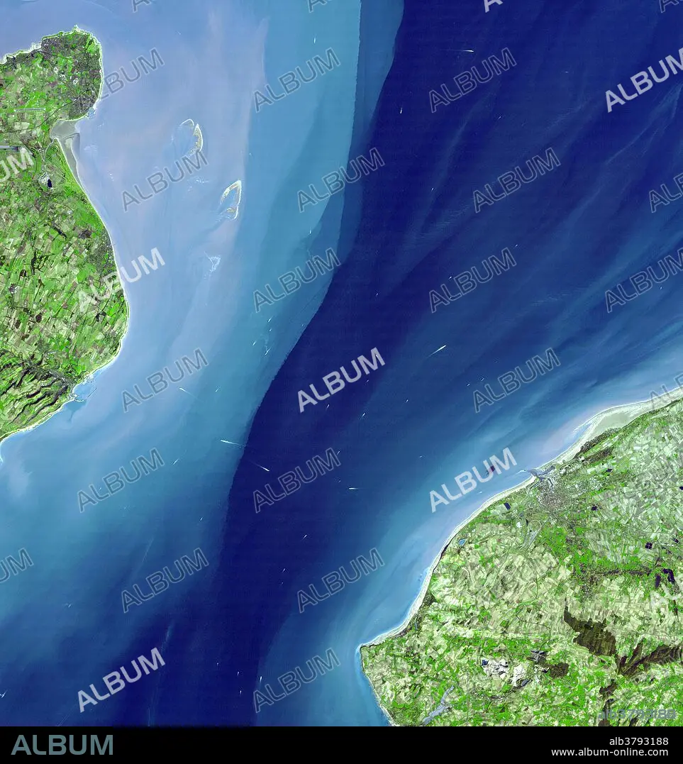
Strait of Dover, satellite image. Sea is blue, vegetation green. The Strait of Dover is the narrowest part of the English Channel, dividing Britain from France. At left is Dover, at the south-eastern point of England. The famous White Cliffs of Dover are just visible along the coastline. At right is Calais in northern France. The white flecks in the water are the wakes of boats and ferries. This image was taken by the Advanced Spaceborne Thermal Emission and Reflection Radiometer (ASTER) on NASA's Terra satellite on March 14th, 2001.
Strait of Dover, satellite image. Sea is blue, vegetation green. The Strait of Dover is the narrowest part of the English Channel, dividing Britain from France. At left is Dover, at the south-eastern point of England. The famous White Cliffs of Dover are just visible along the coastline. At right is Calais in northern France. The white flecks in the water are the wakes of boats and ferries. This image was taken by the Advanced Spaceborne Thermal Emission and Reflection Radiometer (ASTER) on NASA's Terra satellite on March 14th, 2001.
Kategorie: WISSENSCHAFT
Bildnachweis: Album / NASA/Science Source
Freigaben (Releases): ? Modellfreigabe: Nein - ? Eigentumsfreigabe: Nein
Rechtefragen?
Rechtefragen?
Bildgröße: 3960 × 4210 px | 47.7 MB
Druckgröße: 33.5 × 35.6 cm | 1559.1 × 1657.5 in (300 dpi)
Schlüsselwörter: 21. JAHRHUNDERT • ENGLAND • GEOGRAFIE • GEOGRAPHIE • NASA • SATELLIT • WISSENSCHAFT
