alb2184673
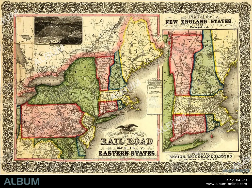
Railroad Map of the Eastern States & New England-1856 1856
| Teilen |
|---|
 Pinterest Pinterest |
 Twitter Twitter |
 Facebook Facebook |
 Link kopieren Link kopieren |
 Email Email |
|
Zu einem anderen Lightbox hinzufügen |
|
Zu einem anderen Lightbox hinzufügen |


Haben Sie bereits ein Konto? Anmelden
Sie haben kein Konto? Registrieren
Dieses Bild kaufen.
Nutzung auswählen:

Titel:
Railroad Map of the Eastern States & New England-1856 1856
Untertitel:
Siehe automatische Übersetzung
Map of New England, part of eastern Canada, New York, Pennsylvania, New Jersey, Delaware, most of Maryland, and part of Virginia. Shows drainage, some relief by hachure's, place names, and state boundaries. "Names of rail roads which are designated by numbers on the annexed 'Plan of the New England States'" appear at the right of the map.
Bildnachweis:
Album / Universal Images Group / Universal History Archive/UIG
Freigaben (Releases):
Bildgröße:
7502 x 5203 px | 111.7 MB
Druckgröße:
63.5 x 44.1 cm | 25.0 x 17.3 in (300 dpi)
Schlüsselwörter:
