alb3801491
Compass Rose, 1607
| Teilen |
|---|
 Pinterest Pinterest |
 Twitter Twitter |
 Facebook Facebook |
 Link kopieren Link kopieren |
 Email Email |
|
Zu einem anderen Lightbox hinzufügen |
|
Zu einem anderen Lightbox hinzufügen |


Haben Sie bereits ein Konto? Anmelden
Sie haben kein Konto? Registrieren
Dieses Bild kaufen

Titel:
Compass Rose, 1607
Untertitel:
Siehe automatische Übersetzung
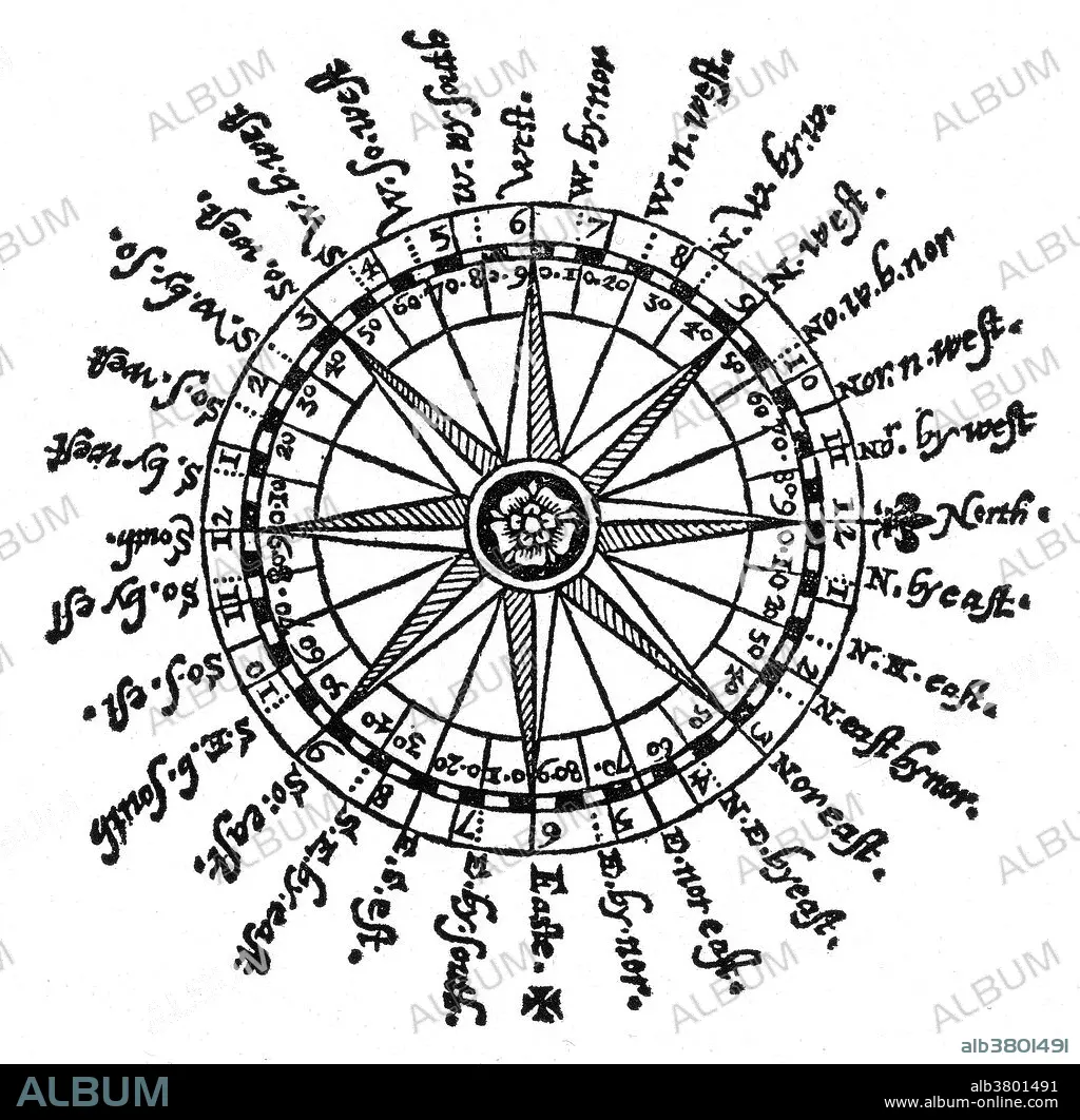
The compass rose is an old design element found on compasses, maps and even monuments to show cardinal directions and frequently intermediate direction. The rose term arises from the fairly ornate figures used with early compasses. Older sources sometimes use the term compass star, or stella maris (star of the sea), to refer to the compass rose. In the Middle Ages, the names of the winds were commonly known throughout the Mediterranean countries as tramontana (N), greco (NE), levante (E), siroco (SE), ostro (S), libeccio (SW), ponente (W) and maestro (NW). The compass rose has appeared on charts and maps since the 1300's when the portolan charts first made their appearance. It is designed in a circle divided into 32 points or 360 degrees numbered clockwise from true or magnetic north, printed on a chart or the like as a means of determining the course of a vessel or aircraft. Appeared in The Seaman's Secrets byThomas Dawson, 1607.
Bildnachweis:
Album / Science Source / New York Public Library
Freigaben (Releases):
Model: Nein - Eigentum: Nein
Rechtefragen?
Rechtefragen?
Bildgröße:
4200 x 4140 px | 49.7 MB
Druckgröße:
35.6 x 35.1 cm | 14.0 x 13.8 in (300 dpi)
Schlüsselwörter:
