alb5535260
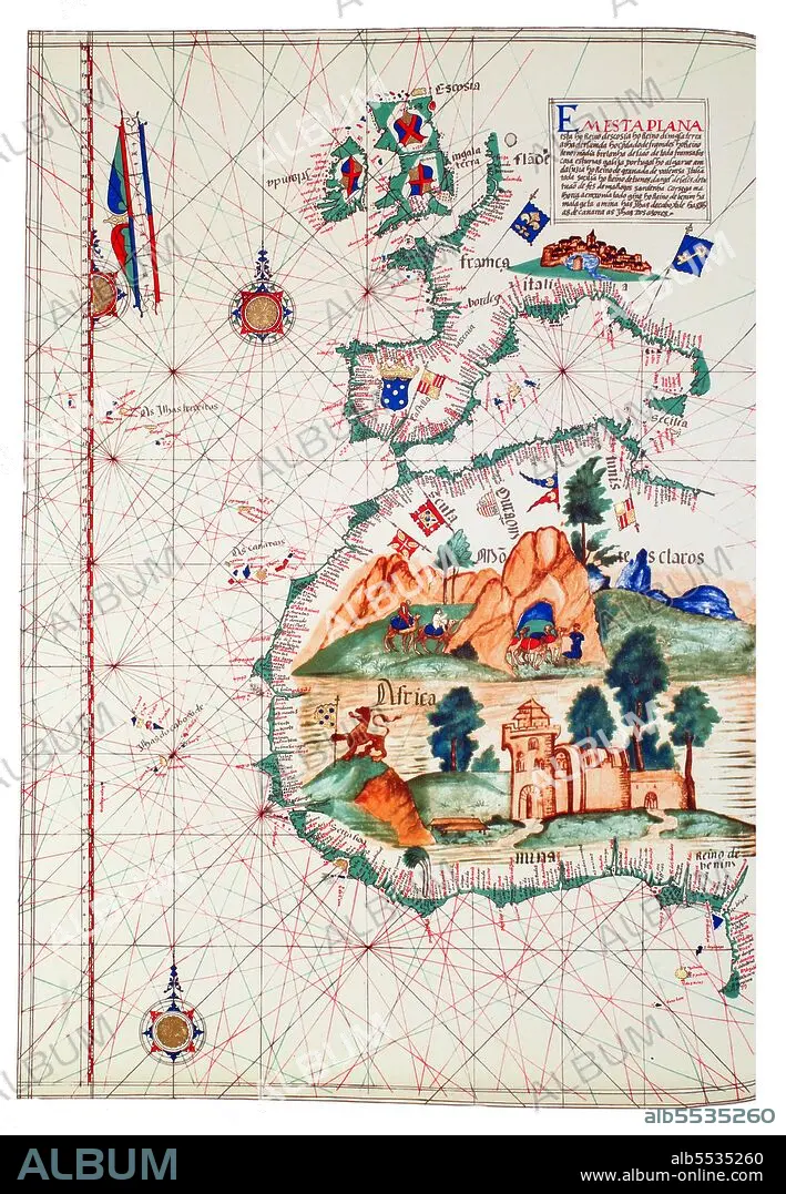
Portugal / West Africa: Map of Western Africa. The large castle in West Africa represents the São Jorge da Mina (Elmina Castle) fortified factory. Lázaro Luis (1563)
| Teilen |
|---|
 Pinterest Pinterest |
 Twitter Twitter |
 Facebook Facebook |
 Link kopieren Link kopieren |
 Email Email |
|
Zu einem anderen Lightbox hinzufügen |
|
Zu einem anderen Lightbox hinzufügen |


Haben Sie bereits ein Konto? Anmelden
Sie haben kein Konto? Registrieren
Dieses Bild kaufen.
Nutzung auswählen:

Titel:
Portugal / West Africa: Map of Western Africa. The large castle in West Africa represents the São Jorge da Mina (Elmina Castle) fortified factory. Lázaro Luis (1563)
Untertitel:
Siehe automatische Übersetzung
Portuguese explorer Prince Henry, known as the Navigator, was the first European to methodically explore Africa and the oceanic route to the Indies. From his residence in the Algarve region of southern Portugal, he directed successive expeditions to circumnavigate Africa and reach India. In 1420, Henry sent an expedition to secure the uninhabited but strategic island of Madeira. In 1425, he tried to secure the Canary Islands as well, but these were already under firm Castilian control. In 1431, another Portuguese expedition reached and annexed the Azores.
Bildnachweis:
Album / Pictures From History/Universal Images Group
Freigaben (Releases):
Bildgröße:
3500 x 5052 px | 50.6 MB
Druckgröße:
29.6 x 42.8 cm | 11.7 x 16.8 in (300 dpi)
Schlüsselwörter:
AFRIKA • AFRIKANER • AFRIKANERIN • AFRIKANISCH • ENTDECKUNG • ERKUNDUNG • GESCHICHTE • GESCHICHTE, PORTUGAL • KARTE (KARTHOGRAFIE) • KARTE • KARTEN • KARTHOGRAFIE • KARTHOGRAPHIE • KARTOGRAFIE (KARTE) • KARTOGRAPHIE • LANDKARTE • LAZARO LUIS • NAVIGATION • PLAN (KARTOGRAPHIE) • PORTUGAL • PORTUGIESISCH • PORTUGIESISCHE KUNST • SPANIEN • WISSENSCH.: KARTOGRAPHIE • ZEITGESCHICHTE
