alb3907898
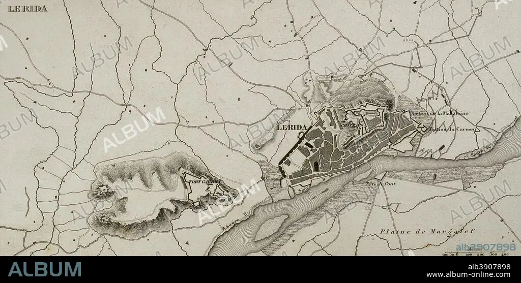
Napoleonic map. City of Lleida (Catalonia, Spain). During The Peninsular War (Napoleonic Wars) the city of Lerida was besieged on 13 May, 1810 by the French army. French victory. Atlas de l'Histoire du Consulat et de l'Empire. History of the Consulate and the Empire of France under Napoleon by Marie Joseph Louis Adolphe Thiers (1797-1877). Drawings by Dufour, engravings by Dyonnet. Edited in Paris, 1864.
| Teilen |
|---|
 Pinterest Pinterest |
 Twitter Twitter |
 Facebook Facebook |
 Link kopieren Link kopieren |
 Email Email |
|
Zu einem anderen Lightbox hinzufügen |
|
Zu einem anderen Lightbox hinzufügen |


Haben Sie bereits ein Konto? Anmelden
Sie haben kein Konto? Registrieren
Dieses Bild kaufen.
Nutzung auswählen:

Untertitel:
Siehe automatische Übersetzung
Napoleonic map. City of Lleida (Catalonia, Spain). During The Peninsular War (Napoleonic Wars) the city of Lerida was besieged on 13 May, 1810 by the French army. French victory. Atlas de l'Histoire du Consulat et de l'Empire. History of the Consulate and the Empire of France under Napoleon by Marie Joseph Louis Adolphe Thiers (1797-1877). Drawings by Dufour, engravings by Dyonnet. Edited in Paris, 1864.
Persönlichkeiten:
Bildnachweis:
Album / Prisma
Freigaben (Releases):
Model: Nein - Eigentum: Nein
Rechtefragen?
Rechtefragen?
Bildgröße:
4961 x 2443 px | 34.7 MB
Druckgröße:
42.0 x 20.7 cm | 16.5 x 8.1 in (300 dpi)
Schlüsselwörter:
ALT (ALTER) • ALTERTÜMLICH • ANTIK • BELAGERUNG • EUROPA • EUROPAEER (F M) • EUROPAEER • EUROPÄER (F M) • EUROPÄER • EUROPÄISCH • FRANKREICH • GEOGRAFIE • GEOGRAPHIE • GESCHICHTE • GRAVUR • ILLUSTRATION • ILLUSTRATIONS • KARTE (KARTHOGRAFIE) • KARTEN • KARTHOGRAFIE • KARTHOGRAPHIE • KARTOGRAFIE (KARTE) • KARTOGRAPHIE • KATALONIEN • KRIEG, NAPOLEONISCH • KRIEG: BELAGERUNG • LANDKARTE • NAPOLEON BONAPARTE • NAPOLEONISCHE KRIEGE • NAPOLEONISCHER KRIEG • PLAN (KARTOGRAPHIE) • SPANIEN • SPANISCHER UNABHAENGIGKEITSKRIEG • SPANISCHER UNABHÄNGIGKEITSKRIEG • STICH (KUNST) • TECHNIK: ZEICHNUNG • WISSENSCH.: KARTOGRAPHIE • ZEICHNEN • ZEICHNUNG • ZEITGESCHICHTE
