alb3936211
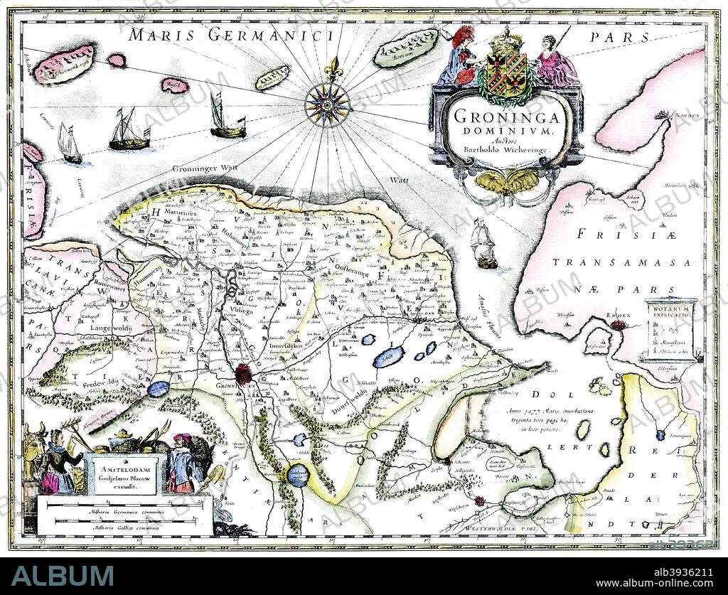
Map of Groningen, Netherlands, 17th century Artist: Unknown
| Teilen |
|---|
 Pinterest Pinterest |
 Twitter Twitter |
 Facebook Facebook |
 Link kopieren Link kopieren |
 Email Email |
|
Zu einem anderen Lightbox hinzufügen |
|
Zu einem anderen Lightbox hinzufügen |


Haben Sie bereits ein Konto? Anmelden
Sie haben kein Konto? Registrieren
Dieses Bild kaufen.
Nutzung auswählen:

Titel:
Map of Groningen, Netherlands, 17th century Artist: Unknown
Untertitel:
Siehe automatische Übersetzung
Map of Groningen, Netherlands, 17th century. A map of the Dutch province of Groningen, published by Willem Blaeu after the original design by Barthold Wicheringe.
Bildnachweis:
Album / Print Collector / Heritage Images
Freigaben (Releases):
Bildgröße:
4777 x 3659 px | 50.0 MB
Druckgröße:
40.4 x 31.0 cm | 15.9 x 12.2 in (300 dpi)
Schlüsselwörter:
