alb10640358
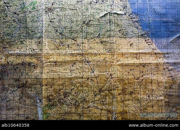
Utah Beach Ordnance Survey map annotated by general Raymond Barton during the D-Day invasion in Normandy, France, Europe.
| Teilen |
|---|
 Pinterest Pinterest |
 Twitter Twitter |
 Facebook Facebook |
 Link kopieren Link kopieren |
 Email Email |
|
Zu einem anderen Lightbox hinzufügen |
|
Zu einem anderen Lightbox hinzufügen |


Haben Sie bereits ein Konto? Anmelden
Sie haben kein Konto? Registrieren
Dieses Bild kaufen

Untertitel:
Siehe automatische Übersetzung
Utah Beach Ordnance Survey map annotated by general Raymond Barton during the D-Day invasion in Normandy, France, Europe
Bildnachweis:
Album / ImageBroker / alimdi / Arterra / Philippe Clément
Freigaben (Releases):
Model: Nein - Eigentum: Nein
Rechtefragen?
Rechtefragen?
Bildgröße:
600 x 400 px | 703.1 KB
Druckgröße:
5.1 x 3.4 cm | 2.0 x 1.3 in (300 dpi)
Schlüsselwörter:
