alb3546299
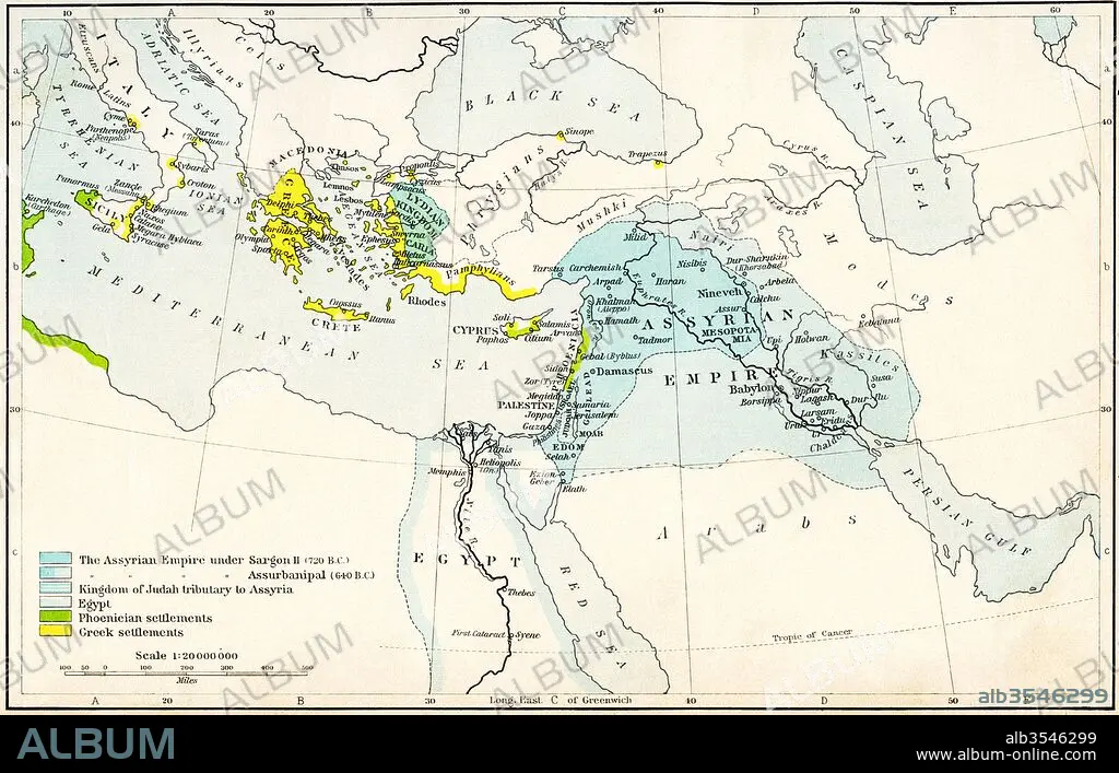
Map of the Assyrian Empire and the region around the eastern Mediterranean, 750-625 B
| Teilen |
|---|
 Pinterest Pinterest |
 Twitter Twitter |
 Facebook Facebook |
 Link kopieren Link kopieren |
 Email Email |
|
Zu einem anderen Lightbox hinzufügen |
|
Zu einem anderen Lightbox hinzufügen |


Haben Sie bereits ein Konto? Anmelden
Sie haben kein Konto? Registrieren
Dieses Bild kaufen

Titel:
Map of the Assyrian Empire and the region around the eastern Mediterranean, 750-625 B
Untertitel:
Siehe automatische Übersetzung
Map of the Assyrian Empire and the region around the eastern Mediterranean, 750 - 625 B.C. From Historical Atlas, published 1923.
Bildnachweis:
Album / Universal Images Group / Universal History Archive
Freigaben (Releases):
Model: Nein - Eigentum: Nein
Rechtefragen?
Rechtefragen?
Bildgröße:
5362 x 3425 px | 52.5 MB
Druckgröße:
45.4 x 29.0 cm | 17.9 x 11.4 in (300 dpi)
Schlüsselwörter:
ALT (ALTER) • ALTERTÜMLICH • ANTIK • ASSYRIAN • EASTERN • GEGEND • GEOGRAFIE • GEOGRAPHIE • KARTE (KARTHOGRAFIE) • KARTE • KARTEN • KARTHOGRAPHIE • LAENDER • LANDKARTE • LÄNDER • PLAN (KARTOGRAPHIE)
