alb9619961
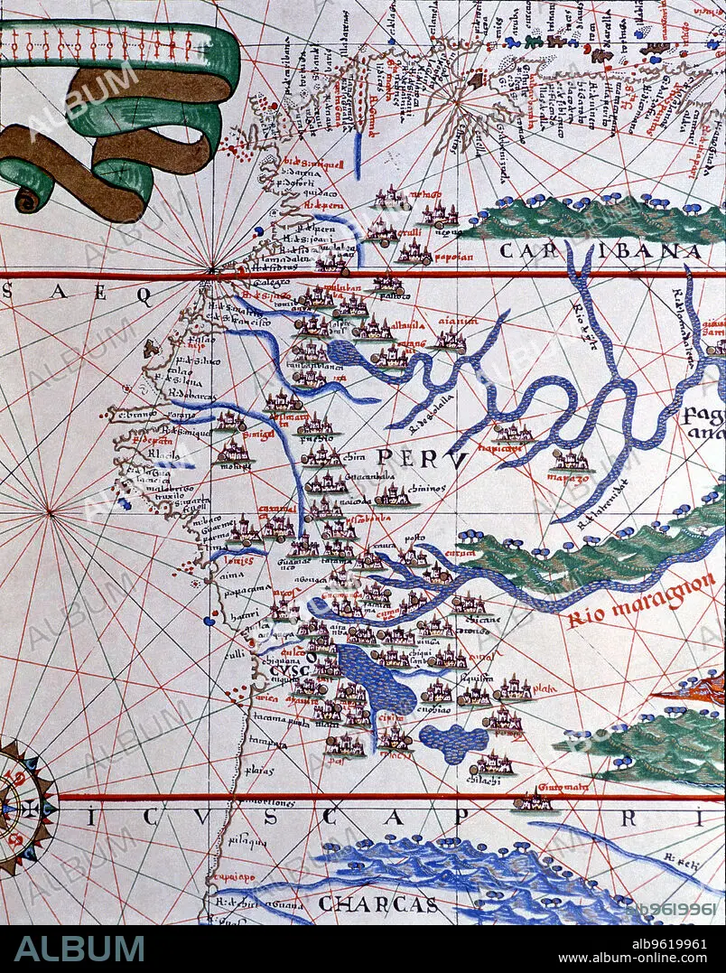
Atlas of Joan Martines, Messina, 1582. Portulan chart of the West Coast of America (Peru, Ecuador…
| Teilen |
|---|
 Pinterest Pinterest |
 Twitter Twitter |
 Facebook Facebook |
 Link kopieren Link kopieren |
 Email Email |
|
Zu einem anderen Lightbox hinzufügen |
|
Zu einem anderen Lightbox hinzufügen |


Haben Sie bereits ein Konto? Anmelden
Sie haben kein Konto? Registrieren
Dieses Bild kaufen.
Nutzung auswählen:

Titel: Atlas of Joan Martines, Messina, 1582. Portulan chart of the West Coast of America (Peru, Ecuador…
Untertitel: Siehe automatische Übersetzung
Atlas of Joan Martines, Messina, 1582. Portulan chart of the West Coast of America (Peru, Ecuador and Colombia).
Atlas of Joan Martines, Messina, 1582. Portulan chart of the West Coast of America (Peru, Ecuador and Colombia).
Bildnachweis: Album / Mithra/Index/Heritage Images
Freigaben (Releases): ? Modellfreigabe: Nein - ? Eigentumsfreigabe: Nein
Rechtefragen?
Rechtefragen?
Bildgröße: 3930 × 5008 px | 56.3 MB
Druckgröße: 33.3 × 42.4 cm | 1547.2 × 1971.7 in (300 dpi)
