alb5364408
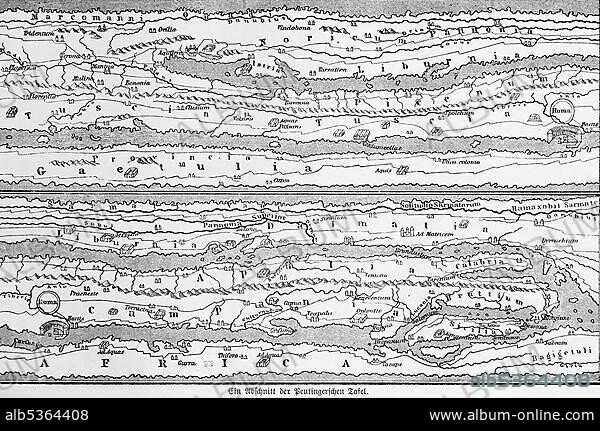
A section from the cartographic representation of the Peutinger's Table (Tabula Peutingeriana), UNESCO World Document Heritage, historical world map, illustration from 1881.
| Teilen |
|---|
 Pinterest Pinterest |
 Twitter Twitter |
 Facebook Facebook |
 Link kopieren Link kopieren |
 Email Email |
|
Zu einem anderen Lightbox hinzufügen |
|
Zu einem anderen Lightbox hinzufügen |


Haben Sie bereits ein Konto? Anmelden
Sie haben kein Konto? Registrieren
Dieses Bild kaufen.
Nutzung auswählen:

Untertitel:
Siehe automatische Übersetzung
A section from the cartographic representation of the Peutinger's Table (Tabula Peutingeriana), UNESCO World Document Heritage, historical world map, illustration from 1881
Bildnachweis:
Album / ImageBroker / Wolfgang Diederich
Freigaben (Releases):
Model: Nein - Eigentum: Nein
Rechtefragen?
Rechtefragen?
Bildgröße:
600 x 398 px | 699.6 KB
Druckgröße:
5.1 x 3.4 cm | 2.0 x 1.3 in (300 dpi)
Schlüsselwörter:
