alb3794442
Lake Okeechobee Complex Fire
| Teilen |
|---|
 Pinterest Pinterest |
 Twitter Twitter |
 Facebook Facebook |
 Link kopieren Link kopieren |
 Email Email |
|
Zu einem anderen Lightbox hinzufügen |
|
Zu einem anderen Lightbox hinzufügen |


Haben Sie bereits ein Konto? Anmelden
Sie haben kein Konto? Registrieren
Dieses Bild kaufen.
Nutzung auswählen:

Titel:
Lake Okeechobee Complex Fire
Untertitel:
Siehe automatische Übersetzung
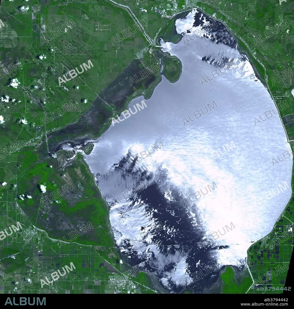
Due to months of intense drought, water levels in Florida's Lake Okeechobee hit record low levels in May and June of 2007, and swampy vegetation around the retreating shoreline began to dry out. At the end of May, more than 10,000 acres of desiccated vegetation burned in a fast-moving, wind-driven wildfire. This image shows the burn scar left on the landscape by the fire, captured on June 23, 2007, by the Advanced Spaceborne Thermal Emission and Reflection Radiometer (ASTER) on NASA's Terra satellite. The image shows a huge scorched swath (long bluish patch between lake and green area at top left) of the marsh between the lake and the surrounding Herbert Hoover Dyke (extreme left of burn scar). The burned area appears charcoal, while vegetation appears green. Lake Okeechobee reflects bright sunlight off of its surface. Lake Okeechobee water levels were nearly 4.5 feet below their long-term average (1965-2006) for this time of year. Much of the area between the burn scar and the lake itself was previously underwater; it was exposed as the water level fell.
Kategorie:
WISSENSCHAFT
Bildnachweis:
Album / NASA/Science Source
Freigaben (Releases):
Bildgröße:
3600 x 3600 px | 37.1 MB
Druckgröße:
30.5 x 30.5 cm | 12.0 x 12.0 in (300 dpi)
Schlüsselwörter:
