alb4064959
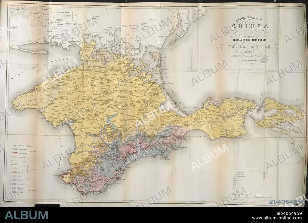
DEMIDOV, ANATOLY NIKOLAEVICH, PRINCE DI SAN DONATO. A 19th century map of the Crimea. Travels in Southern Russia, and the Crimea; through Hungary, Wallachia, & Moldavia, during the year 1837. John Mitchell: London, 1853. Source: 10290.f.2 volume 2,. Language: English.
| Teilen |
|---|
 Pinterest Pinterest |
 Twitter Twitter |
 Facebook Facebook |
 Link kopieren Link kopieren |
 Email Email |
|
Zu einem anderen Lightbox hinzufügen |
|
Zu einem anderen Lightbox hinzufügen |


Haben Sie bereits ein Konto? Anmelden
Sie haben kein Konto? Registrieren
Dieses Bild kaufen.
Nutzung auswählen:

Untertitel: Siehe automatische Übersetzung
A 19th century map of the Crimea. Travels in Southern Russia, and the Crimea; through Hungary, Wallachia, & Moldavia, during the year 1837. John Mitchell: London, 1853. Source: 10290.f.2 volume 2,. Language: English.
A 19th century map of the Crimea. Travels in Southern Russia, and the Crimea; through Hungary, Wallachia, & Moldavia, during the year 1837. John Mitchell: London, 1853. Source: 10290.f.2 volume 2,. Language: English.
Bildnachweis: Album / British Library
Freigaben (Releases): ? Modellfreigabe: Nein - ? Eigentumsfreigabe: Nein
Rechtefragen?
Rechtefragen?
Bildgröße: 5392 × 3628 px | 56.0 MB
Druckgröße: 45.7 × 30.7 cm | 2122.8 × 1428.3 in (300 dpi)
Schlüsselwörter: ADLIGER, ADEL • DEMIDOV, ANATOLY NIKOLAEVICH, PRINCE DI SAN DONATO • ENGLAND • FARBE • FARBEN • FARBIG • FUERST • FÜRST • GROSSBRITANNIEN • KARTE (KARTHOGRAFIE) • KARTEN • KARTHOGRAFIE • KARTHOGRAPHIE • KARTOGRAFIE (KARTE) • KARTOGRAPHIE • LANDKARTE • PLAN (KARTOGRAPHIE) • PRINZ • WISSENSCH.: KARTOGRAPHIE
