alb1962027
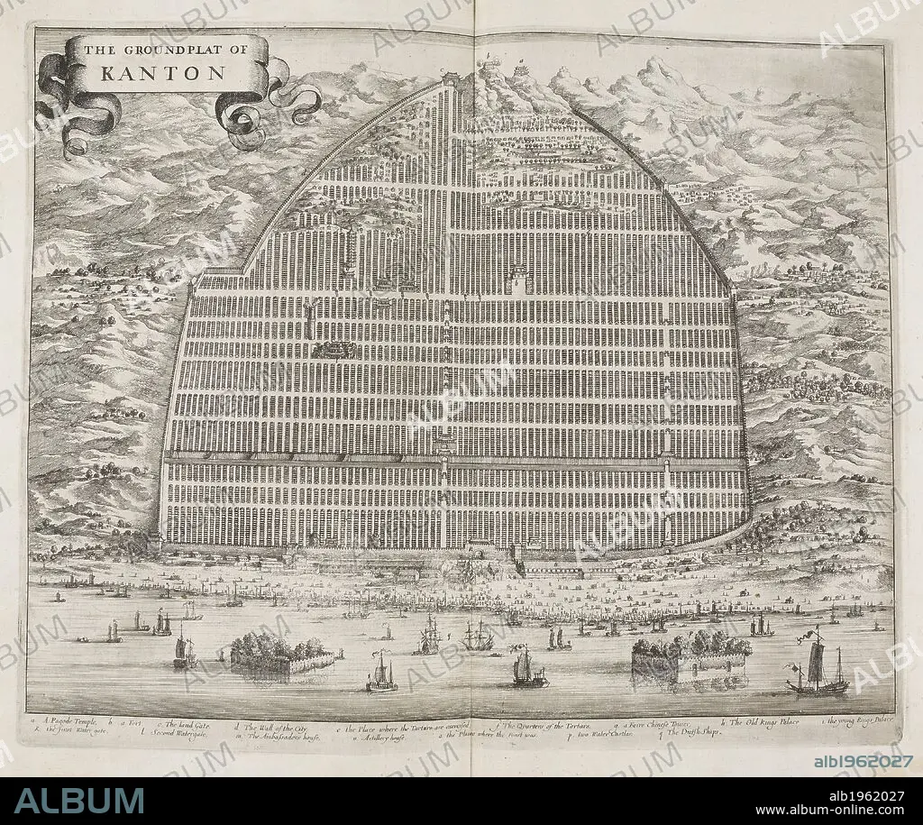
W BRAMSTON. The Ground Flat of Kanton. A map of the city of Canton in 1840. Street plan. China. . The Groundflat of Kanton. China. Canton. A Plan of the City of Canton and its Suburbs showing the principal Streets and some of the conspicuous Buildings from a Chinese Survey on an Enlarged Scale with additions and References, by W. Bramston, Late of Her Majesty’s Superintendents Office at Canton. Source: X.1202. Language: English.
| Teilen |
|---|
 Pinterest Pinterest |
 Twitter Twitter |
 Facebook Facebook |
 Link kopieren Link kopieren |
 Email Email |
|
Zu einem anderen Lightbox hinzufügen |
|
Zu einem anderen Lightbox hinzufügen |


Haben Sie bereits ein Konto? Anmelden
Sie haben kein Konto? Registrieren
Dieses Bild kaufen.
Nutzung auswählen:

Autor:
Untertitel:
Siehe automatische Übersetzung
The Ground Flat of Kanton. A map of the city of Canton in 1840. Street plan. China. . The Groundflat of Kanton. China. Canton. A Plan of the City of Canton and its Suburbs showing the principal Streets and some of the conspicuous Buildings from a Chinese Survey on an Enlarged Scale with additions and References, by W. Bramston, Late of Her Majesty’s Superintendents Office at Canton. Source: X.1202. Language: English.
Persönlichkeiten:
Bildnachweis:
Album / British Library
Freigaben (Releases):
Model: Nein - Eigentum: Nein
Rechtefragen?
Rechtefragen?
Bildgröße:
4626 x 3894 px | 51.5 MB
Druckgröße:
39.2 x 33.0 cm | 15.4 x 13.0 in (300 dpi)
Schlüsselwörter:
