alb3909131
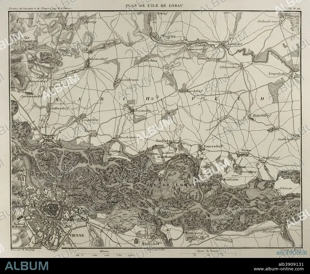
Napoleonic map. Island of Lobau (near Vienna, Austria). Battles were fought on this area during the Napoleonic Wars between Austria and France. Atlas de l'Histoire du Consulat et de l'Empire. History of the Consulate and the Empire of France under Napoleon by Marie Joseph Louis Adolphe Thiers (1797-1877). Drawings by Dufour, engravings by Dyonnet. Edited in Paris, 1864.
| Teilen |
|---|
 Pinterest Pinterest |
 Twitter Twitter |
 Facebook Facebook |
 Link kopieren Link kopieren |
 Email Email |
|
Zu einem anderen Lightbox hinzufügen |
|
Zu einem anderen Lightbox hinzufügen |


Haben Sie bereits ein Konto? Anmelden
Sie haben kein Konto? Registrieren
Dieses Bild kaufen.
Nutzung auswählen:

Untertitel: Siehe automatische Übersetzung
Napoleonic map. Island of Lobau (near Vienna, Austria). Battles were fought on this area during the Napoleonic Wars between Austria and France. Atlas de l'Histoire du Consulat et de l'Empire. History of the Consulate and the Empire of France under Napoleon by Marie Joseph Louis Adolphe Thiers (1797-1877). Drawings by Dufour, engravings by Dyonnet. Edited in Paris, 1864.
Napoleonic map. Island of Lobau (near Vienna, Austria). Battles were fought on this area during the Napoleonic Wars between Austria and France. Atlas de l'Histoire du Consulat et de l'Empire. History of the Consulate and the Empire of France under Napoleon by Marie Joseph Louis Adolphe Thiers (1797-1877). Drawings by Dufour, engravings by Dyonnet. Edited in Paris, 1864.
Persönlichkeiten: NAPOLEON BONAPARTE (1769-1821)
Bildnachweis: Album / Prisma
Freigaben (Releases): ? Modellfreigabe: Nein - ? Eigentumsfreigabe: Nein
Rechtefragen?
Rechtefragen?
Bildgröße: 4370 × 3636 px | 45.5 MB
Druckgröße: 37.0 × 30.8 cm | 1720.5 × 1431.5 in (300 dpi)
Schlüsselwörter: ALT (ALTER) • ALTERTÜMLICH • ANTIK • DONAU, FLUSS • EUROPA • EUROPAEER (F M) • EUROPAEER • EUROPÄER (F M) • EUROPÄER • EUROPÄISCH • FEUER, KRIEG • FLUSS DONAU • FRANKREICH • GEOGRAFIE • GEOGRAPHIE • GESCHICHTE • HAUPTSTADT • ILLUSTRATION • ILLUSTRATIONS • INSEL • KARTE (KARTHOGRAFIE) • KARTEN • KARTHOGRAFIE • KARTHOGRAPHIE • KARTOGRAFIE (KARTE) • KARTOGRAPHIE • KRIEG • KRIEG, NAPOLEONISCH • LANDKARTE • NAPOLEON BONAPARTE • NAPOLEONISCHE KRIEGE • NAPOLEONISCHER KRIEG • OESTERREICH • PLAN (KARTOGRAPHIE) • SCHLACHTFELD • TECHNIK: ZEICHNUNG • URBANISMUS • URBANISTIK • WIEN • WISSENSCH.: KARTOGRAPHIE • ZEICHNEN • ZEICHNUNG • ZEITGESCHICHTE
