alb3833749
France, SRTM Image
| Teilen |
|---|
 Pinterest Pinterest |
 Twitter Twitter |
 Facebook Facebook |
 Link kopieren Link kopieren |
 Email Email |
|
Zu einem anderen Lightbox hinzufügen |
|
Zu einem anderen Lightbox hinzufügen |


Haben Sie bereits ein Konto? Anmelden
Sie haben kein Konto? Registrieren
Dieses Bild kaufen.
Nutzung auswählen:

Titel:
France, SRTM Image
Untertitel:
Siehe automatische Übersetzung
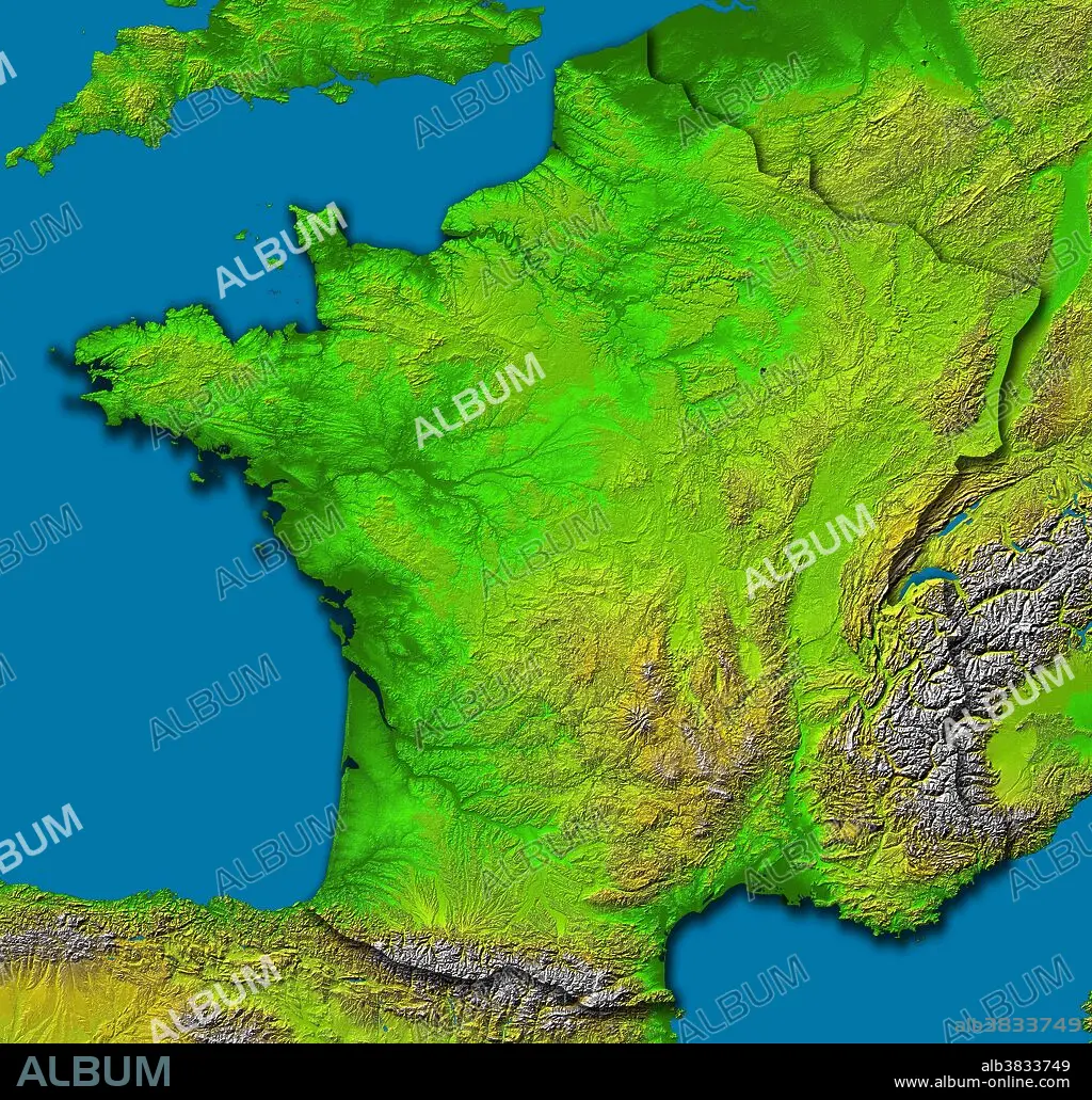
Image of France was generated with data from the SRTM aboard Endeavour. The upper central part of this scene is dominated by the Paris Basin, which consists of a layered sequence of sedimentary rocks. Fertile soils over much of the area make good agricultural land. The Normandie coast to the upper left is characterized by high, chalk cliffs, while the Brittany coast is highly indented where deep valleys were drowned by the sea, and the Biscay coast to the southwest is marked by flat, sandy beaches The Pyrenees form a natural border between France and Spain, and the south-central part of the country is dominated by the ancient Massif Central. Subject to volcanism that has only subsided in the last 10,000 years, these central mountains are separated from the Alps by the north-south trending Rhone River Basin. Color coding is directly related to topographic height, with green at the lower elevations, rising through yellow and tan, to white at the highest elevations.
Bildnachweis:
Album / Science Source / NASA/JPL/NIMA
Freigaben (Releases):
Model: Nein - Eigentum: Nein
Rechtefragen?
Rechtefragen?
Bildgröße:
8688 x 8296 px | 206.2 MB
Druckgröße:
73.6 x 70.2 cm | 29.0 x 27.7 in (300 dpi)
Schlüsselwörter:
