alb15764409
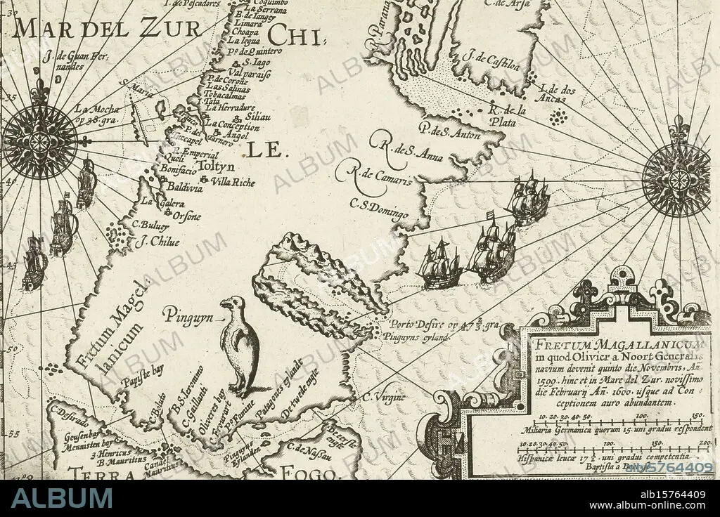
Map of the southern tip of South America with the Strait of Magellan, 1599-1600, Fretum Magallanicum (title on object), Map of the southern tip of South America and the Strait of Magellan, where Olivier van Noort's expedition arrived in November 1599 and funeral again in February 1600. The route of the three ships is plotted on the map. A penguin on land. Bottom right a cartouche with title and scales. Part of the illustrations in the report of the journey around the world by Olivier van Noort in 1598-1601. No. 8., print, print maker: Baptista van Doetechum, (mentioned on object), Northern Netherlands, 1601 - 1602 and/or 1646, paper, etching, engraving, height c. 145 mm × width c. 225 mm.
| Teilen |
|---|
 Pinterest Pinterest |
 Twitter Twitter |
 Facebook Facebook |
 Link kopieren Link kopieren |
 Email Email |
|
Zu einem anderen Lightbox hinzufügen |
|
Zu einem anderen Lightbox hinzufügen |


Haben Sie bereits ein Konto? Anmelden
Sie haben kein Konto? Registrieren
Dieses Bild kaufen.
Nutzung auswählen:

Untertitel:
Siehe automatische Übersetzung
Map of the southern tip of South America with the Strait of Magellan, 1599-1600, Fretum Magallanicum (title on object), Map of the southern tip of South America and the Strait of Magellan, where Olivier van Noort's expedition arrived in November 1599 and funeral again in February 1600. The route of the three ships is plotted on the map. A penguin on land. Bottom right a cartouche with title and scales. Part of the illustrations in the report of the journey around the world by Olivier van Noort in 1598-1601. No. 8., print, print maker: Baptista van Doetechum, (mentioned on object), Northern Netherlands, 1601 - 1602 and/or 1646, paper, etching, engraving, height c. 145 mm × width c. 225 mm
Bildnachweis:
Album / quintlox
Freigaben (Releases):
Bildgröße:
5750 x 3837 px | 63.1 MB
Druckgröße:
48.7 x 32.5 cm | 19.2 x 12.8 in (300 dpi)
Schlüsselwörter:
ABDRUCK • ACHT • GRAVUR • ILLUSTRATION • ILLUSTRATIONS • KARTE (KARTHOGRAFIE) • KARTEN • KARTHOGRAPHIE • LANDKARTE • OBJEKT • PAPIER • PINGUIN • PLAN (KARTOGRAPHIE) • REISE • REISENDER • STICH (KUNST) • SÜDAMERIKA • WALZ • WELT
