alb3818722
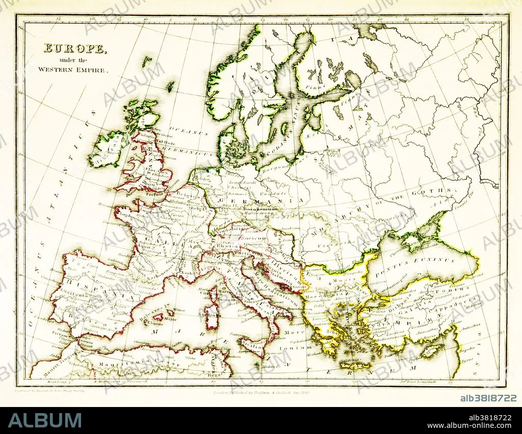
Western Roman Empire, 3rd Century
| Teilen |
|---|
 Pinterest Pinterest |
 Twitter Twitter |
 Facebook Facebook |
 Link kopieren Link kopieren |
 Email Email |
|
Zu einem anderen Lightbox hinzufügen |
|
Zu einem anderen Lightbox hinzufügen |


Haben Sie bereits ein Konto? Anmelden
Sie haben kein Konto? Registrieren
Dieses Bild kaufen

Titel:
Western Roman Empire, 3rd Century
Untertitel:
Siehe automatische Übersetzung
A map of Europe, showing the borders of the Western Roman Empire, which reached its greatest extent around 400 CE. A Western Roman Empire existed intermittently in several periods between the 3rd and 5th centuries (285 - 476 CE). Map published in 1831.
Bildnachweis:
Album / Science Source / British Library
Freigaben (Releases):
Model: Nein - Eigentum: Nein
Rechtefragen?
Rechtefragen?
Bildgröße:
3543 x 2766 px | 28.0 MB
Druckgröße:
30.0 x 23.4 cm | 11.8 x 9.2 in (300 dpi)
Schlüsselwörter:
