alb4095517
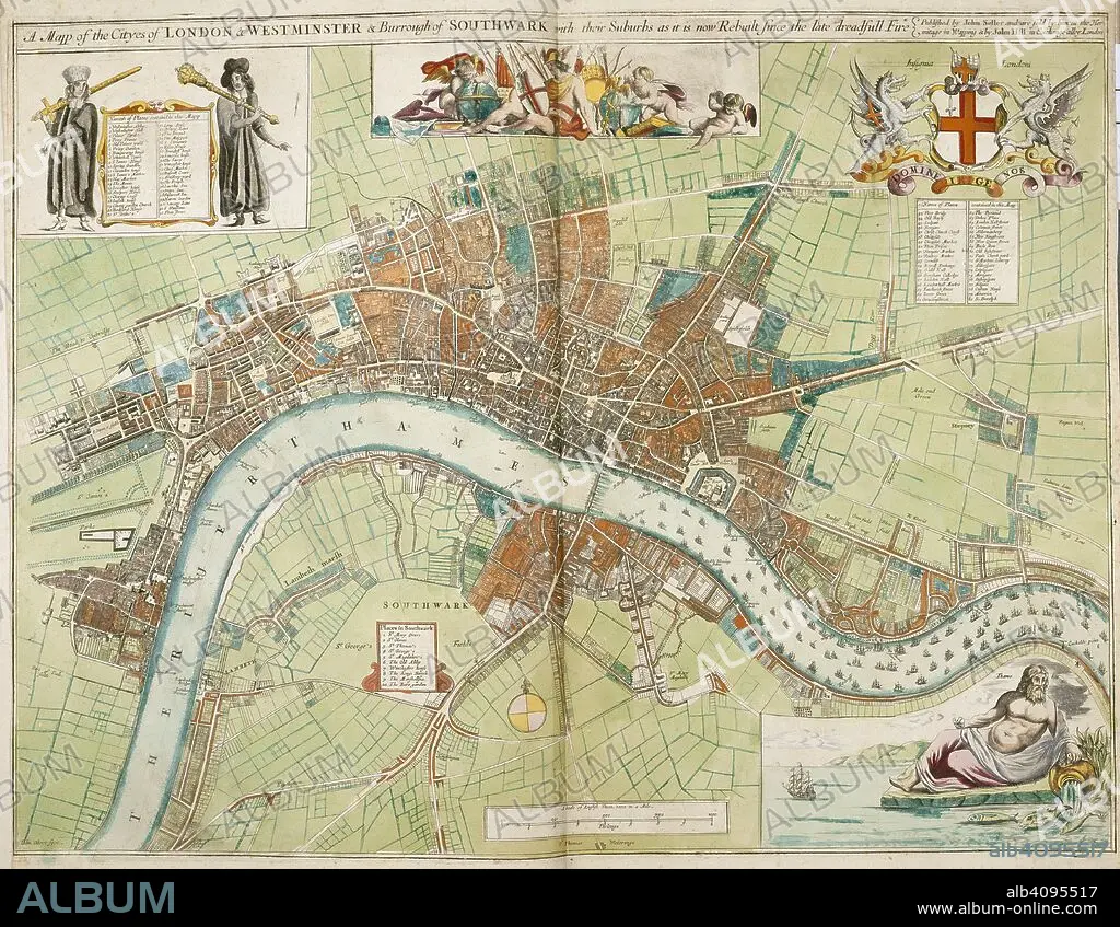
A map of the cities of London and Westminster and the Borough of Southwark with their suburbs, as it is now rebuilt since the late dreadful fire. A Collection of the County Mapps of the Kingdome of England and Principality of Wales, by John Seller (with a Map of Scotland and a Map of Ireland, a Plan of London and twenty-seven Views of its principal buildings). 1680. Source: Maps 1.TAB.18, page 4. Language: English.
| Teilen |
|---|
 Pinterest Pinterest |
 Twitter Twitter |
 Facebook Facebook |
 Link kopieren Link kopieren |
 Email Email |
|
Zu einem anderen Lightbox hinzufügen |
|
Zu einem anderen Lightbox hinzufügen |


Haben Sie bereits ein Konto? Anmelden
Sie haben kein Konto? Registrieren
Dieses Bild kaufen

Autor:
Untertitel:
Siehe automatische Übersetzung
A map of the cities of London and Westminster and the Borough of Southwark with their suburbs, as it is now rebuilt since the late dreadful fire. A Collection of the County Mapps of the Kingdome of England and Principality of Wales, by John Seller (with a Map of Scotland and a Map of Ireland, a Plan of London and twenty-seven Views of its principal buildings). 1680. Source: Maps 1.TAB.18, page 4. Language: English.
Bildnachweis:
Album / British Library
Freigaben (Releases):
Model: Nein - Eigentum: Nein
Rechtefragen?
Rechtefragen?
Bildgröße:
5550 x 4303 px | 68.3 MB
Druckgröße:
47.0 x 36.4 cm | 18.5 x 14.3 in (300 dpi)
Schlüsselwörter:
17. JAHRHUNDERT • 17. JH. • ADELSWAPPEN • ENGLAND • EUROPA • FLUSS THEMSE • GROSSBRITANNIEN • GROßBRITANNIEN • KARTE (KARTHOGRAFIE) • KARTEN • KARTHOGRAFIE • KARTHOGRAPHIE • KARTOGRAFIE (KARTE) • KARTOGRAPHIE • LANDKARTE • LONDON • PLAN (KARTOGRAPHIE) • SELLER, JOHN • THEMSE, FLUSS • WISSENSCH.: KARTOGRAPHIE
