alb4190452
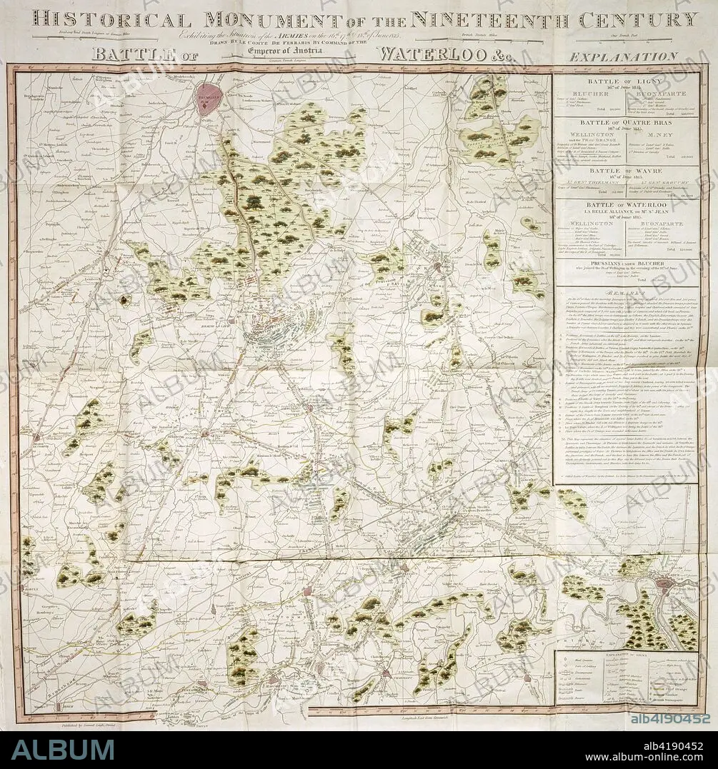
Map of the Waterloo campaign, 1815, Walmer Castle, Kent. Artist: Unknown.
| Teilen |
|---|
 Pinterest Pinterest |
 Twitter Twitter |
 Facebook Facebook |
 Link kopieren Link kopieren |
 Email Email |
|
Zu einem anderen Lightbox hinzufügen |
|
Zu einem anderen Lightbox hinzufügen |


Haben Sie bereits ein Konto? Anmelden
Sie haben kein Konto? Registrieren
Dieses Bild kaufen.
Nutzung auswählen:

Titel: Map of the Waterloo campaign, 1815, Walmer Castle, Kent. Artist: Unknown.
Untertitel: Siehe automatische Übersetzung
Map of the Waterloo campaign, 1815, Walmer Castle, Kent. Map Exhibiting the Situation of the Armies on the 16, 17 & 18 of June 1815. The Battle of Ligny, Quatre Bras, Waterloo and Wavre.
Map of the Waterloo campaign, 1815, Walmer Castle, Kent. Map Exhibiting the Situation of the Armies on the 16, 17 & 18 of June 1815. The Battle of Ligny, Quatre Bras, Waterloo and Wavre.
Bildnachweis: Album / Heritage Images / Historic England Archive
Freigaben (Releases): ? Modellfreigabe: Nein - ? Eigentumsfreigabe: Nein
Rechtefragen?
Rechtefragen?
Bildgröße: 3623 × 3691 px | 38.3 MB
Druckgröße: 30.7 × 31.3 cm | 1426.4 × 1453.1 in (300 dpi)
Schlüsselwörter: ARMEE • ARMY • BELGIEN • FARBE • FARBIG • FEUER, KRIEG • HEER • KRIEG • KRIEG, NAPOLEONISCH • NAPOLEONISCHE KRIEGE • NAPOLEONISCHER KRIEG • SCHLACHT VON WATERLOO
