alb9507328
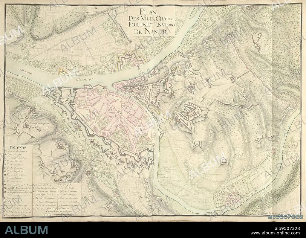
Map of Namur, ca. 1701-1715, Nicolas Suly, 1701 - 1715, Map of the fortifications around the city of Namur with the castle, ca. 1701-1715. Bottom left legend A-Z and 1-13 in French. Part of a collection of drawn plans of fortified towns in the Netherlands and surrounding countries at the time of the War of the Spanish Succession (part B)., draughtsman: Nicolas Suly, (mentioned on object), Netherlands, 1701 - 1715, paper, h 530 mm × w 730 mm.
| Teilen |
|---|
 Pinterest Pinterest |
 Twitter Twitter |
 Facebook Facebook |
 Link kopieren Link kopieren |
 Email Email |
|
Zu einem anderen Lightbox hinzufügen |
|
Zu einem anderen Lightbox hinzufügen |


Haben Sie bereits ein Konto? Anmelden
Sie haben kein Konto? Registrieren
Dieses Bild kaufen.
Nutzung auswählen:

Untertitel:
Siehe automatische Übersetzung
Map of Namur, ca. 1701-1715, Nicolas Suly, 1701 - 1715, Map of the fortifications around the city of Namur with the castle, ca. 1701-1715. Bottom left legend A-Z and 1-13 in French. Part of a collection of drawn plans of fortified towns in the Netherlands and surrounding countries at the time of the War of the Spanish Succession (part B)., draughtsman: Nicolas Suly, (mentioned on object), Netherlands, 1701 - 1715, paper, h 530 mm × w 730 mm
Bildnachweis:
Album / quintlox
Freigaben (Releases):
Model: Nein - Eigentum: Nein
Rechtefragen?
Rechtefragen?
Bildgröße:
6086 x 4418 px | 76.9 MB
Druckgröße:
51.5 x 37.4 cm | 20.3 x 14.7 in (300 dpi)
Schlüsselwörter:
FEUER, KRIEG • FRANZOESISCH • FRANZOSE • FRANZÖSIN • KARTE (KARTHOGRAFIE) • KARTEN • KARTHOGRAPHIE • KRIEG • LANDKARTE • OBJEKT • PAPIER • PLAN (KARTOGRAPHIE) • SCHLOSS ALLE • SCHLOSS • STADT • STÄDTE • TECHNISCHER ZEICHNER • ZEIT
