alb5480506
Ethiopia / Sudan / South Sudan: A Map of the Abyssinian Empire,1683
| Teilen |
|---|
 Pinterest Pinterest |
 Twitter Twitter |
 Facebook Facebook |
 Link kopieren Link kopieren |
 Email Email |
|
Zu einem anderen Lightbox hinzufügen |
|
Zu einem anderen Lightbox hinzufügen |


Haben Sie bereits ein Konto? Anmelden
Sie haben kein Konto? Registrieren
Dieses Bild kaufen.
Nutzung auswählen:

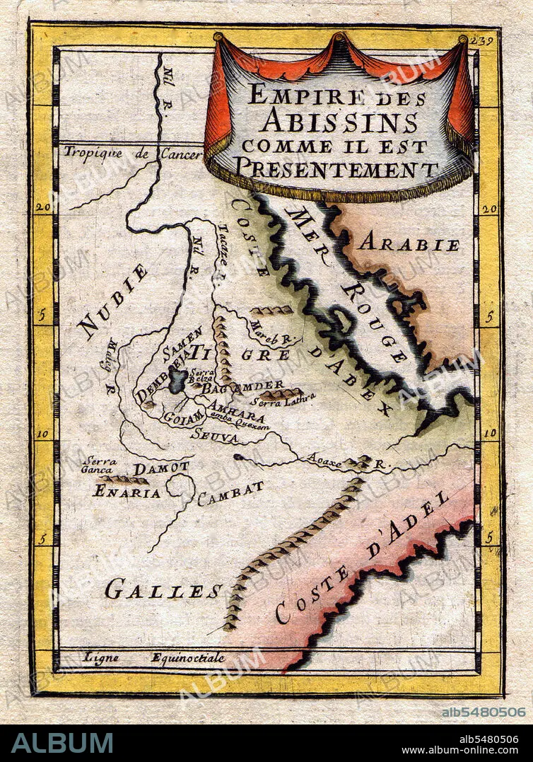
Titel: Ethiopia / Sudan / South Sudan: A Map of the Abyssinian Empire,1683
Untertitel: Siehe automatische Übersetzung
A French map of the Red Sea and East African Coast dated 1683 and showing parts of Arabia, Nubia, Sudan, South Sudan, Somalia and East Africa.
A French map of the Red Sea and East African Coast dated 1683 and showing parts of Arabia, Nubia, Sudan, South Sudan, Somalia and East Africa.
Bildnachweis: Album / Pictures From History/Universal Images Group
Freigaben (Releases): ? Modellfreigabe: Nein - ? Eigentumsfreigabe: Nein
Rechtefragen?
Rechtefragen?
Bildgröße: 3600 × 4887 px | 50.3 MB
Druckgröße: 30.5 × 41.4 cm | 1417.3 × 1924.0 in (300 dpi)
Schlüsselwörter: AFRIKA • GESCHICHTE • KARTE (KARTHOGRAFIE) • KARTE • KARTEN • KARTHOGRAFIE • KARTHOGRAPHIE • KARTOGRAFIE (KARTE) • KARTOGRAPHIE • LANDKARTE • PLAN (KARTOGRAPHIE) • SUDAN • WISSENSCH.: KARTOGRAPHIE • ZEITGESCHICHTE • ÄTHIOPIEN
